
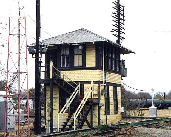
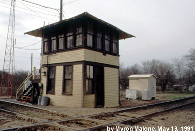
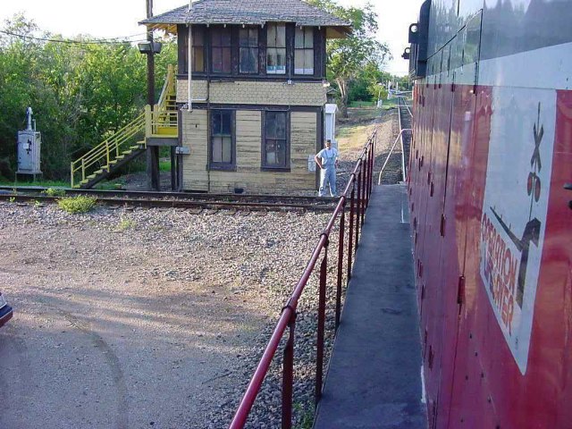
Above: Tower 16, photographed by Larry Paul shortly before it was decommissioned in 2001
Crossings of the Texas & Pacific Railway, the Houston & Texas Central Railway, and the St. Louis & San Francisco Railway
Above:
Tower 16, photographed by Larry Paul shortly before it was decommissioned in
2001
Sherman was an early settlement in Texas, founded
in 1846 for its location near the
center of the newly authorized Grayson County. The Houston & Texas
Central (H&TC) Railway arrived from the south in 1872 as it continued
construction north from
Houston through Dallas heading for the Red River
fourteen miles
north of Sherman. That same year,
the Missouri, Kansas & Texas (MK&T, "Katy") Railroad bridged the Red River and built
five miles south to the new town of Denison
(named for a Katy vice president), providing rail connections to the Midwest and
beyond. This was a boon to the economy of both Denison and Sherman and they grew
rapidly. The two railroads worked cooperatively exchanging freight at Denison, and they soon
established passenger service connecting Kansas City and St. Louis with
Houston and
Galveston. By the end of 1883, the H&TC had become controlled by Southern
Pacific (SP).
In 1873, the Texas & Pacific (T&P) Railway built 54 miles
east from Sherman to
Brookston, the initial segment of an east / west line that was completed into
Texarkana in 1876. Sherman was the starting
point because construction materials could be shipped on the H&TC from ports in
Galveston and Houston. The T&P had obtained a Federal charter from
Congress to build a southern transcontinental line between Texarkana and San
Diego. A route strategy across Texas had been established years earlier by the Texas Legislature when it
authorized railroad charters for the predecessor companies that had been acquired by the T&P. Those charters
called for two parallel routes from Texarkana to Fort
Worth -- a southern route that went south to Marshall and then west to Fort
Worth, and a northern route paralleling the Red River to Grayson County that
would then turn southwest to Fort Worth. From Fort Worth, a single line would be
built to El Paso.
About the time the T&P
began construction, rail baron Jay Gould was contemplating
ways to get access to Galveston's port for agricultural commodities his Midwest railroads carried. He began eyeing the Katy as
a railroad he could expand southward across Texas to the Gulf, but it also connected with his railroads in Missouri. Unfortunately for Gould, he could
not simply buy a controlling interest in the Katy. Its stock had become so
diluted and widely dispersed among small stockholders that there were few large
blocks available for private purchase, and there simply weren't enough
shares circulating on the open market. Author
Wayne Cline in his 2015 book The Texas Railroad
explains that Gould's plan to take over the Katy began innocuously on October 22,
1873 when...
"...he stage-managed the election of a loyal ally, William Bond, as the road's second vice president. Bond proceeded to fire key Katy managers and replace them with Gould's henchmen. On December 21, 1874 Bond was appointed receiver of the MKT, and on March 1, 1876 he became the Katy's general manager. By December, 1879, Bond had brought so many Gould supporters aboard the MKT that Jay was elected president."
The end result was that Gould had little ownership
interest in the Katy; he was merely its President. To ensure his continued
control, Gould leased the Katy in December, 1880 to the Missouri Pacific (MP)
Railroad, a large Missouri-based enterprise controlled by Gould in which he had
a large ownership position. Gould planned an expansion of the Katy deep into
Texas, intending to use it to route long-haul traffic to and from MP. The lease
was onerous to the Katy, the result of accounting and operating policies tilted heavily toward MP. MP stockholders would reap the benefits of Katy operations
through profit transfers; the Katy would simply
break even. Katy stockholders were powerless to correct the situation unless a
majority of them could band together to call a formal stockholders' meeting. With the stock
heavily diluted, this seemed an impossible task.
Gould had also begun targeting the
T&P which was having difficulty raising funds for its pending construction
from Fort Worth to El Paso. Gould established a syndicate to purchase the stock
of T&P President Thomas Scott for $3.5 million and offered to lay T&P's tracks toward El Paso in
exchange for $20,000 in T&P stocks and $20,000 in T&P bonds for each mile
completed. With the offer accepted, Gould restarted T&P construction west from
Fort Worth in 1879. As construction proceeded, Gould progressively gained financial
control of the T&P with each mile built. He was named President in April, 1881. The T&P's track
construction never reached El Paso, stopping instead at Sierra Blanca where a
deal between Gould and SP Chairman C. P. Huntington resulted
in the T&P sharing SP's track into El Paso.
In 1879, Katy investors
and other interests chartered the Denison & Pacific (D&P) Railroad and
built a line west from Denison to
Gainesville. In November, 1881, Gould directed the
Katy to acquire formal ownership of the D&P tracks. This was important because a
few months earlier, Gould had begun his presidency of the T&P by starting to
build its line from Sherman to Fort Worth, the last remaining track segment of
the T&P's original route strategy. Gould directed that construction proceed from
Sherman west to Whitesboro and then turn southwest to Fort Worth. He did this
because the Katy's D&P line had passed through Whitesboro, about seventeen miles due west of Sherman.
Thus, a T&P / Katy connection
could be established in Whitesboro effectively creating a direct route between Denison and Fort Worth for the Katy.
Upon completion, Gould directed the T&P to sell unlimited rights on the
Whitesboro - Fort Worth segment, effectively creating a main line for the Katy
between its Red River bridge and Fort Worth. The Whitesboro - Fort Worth segment became known as the
Joint Track for the next hundred years, and the railroads shared its
maintenance expenses.
South of Whitesboro, the Joint Track passed through
the town of Denton which Gould saw as a connecting point for service to Dallas
(the T&P already served Dallas with its main east / west line from Texarkana via
Marshall.) Under T&P ownership, Gould bought the bankrupt Dallas & Wichita
Railway and extended it seventeen miles north to Denton. The T&P then sold this
Dallas - Denton line to the Katy in December, 1881, giving the Katy its own route
between Denison and Dallas via Whitesboro and Denton. The Katy came under lease
to MP that same month, and Gould ensured that all construction publicity
attributed this work to MP. The Katy now had its own routes
from Denison to Fort Worth and Dallas, but to the
public, this was simply an MP expansion further into Texas.
 |
In 1886, the St. Louis, Arkansas & Texas (SLA&T) Railway took over the
bankrupt Texas & St. Louis Railway and converted its tracks from narrow gauge to
standard gauge. The SLA&T's primary route ran from Texarkana to Mt. Pleasant,
then southwest to Tyler, Waco and beyond. To capitalize on the burgeoning rail
activity at Sherman, the SLA&T built 109 miles from Mt. Pleasant to Sherman in
1887. The main line connection at Mt. Pleasant
gave the SLA&T a direct route
between Sherman and Texarkana, longer but essentially parallel to T&P's
northern line, and with greater population. Financial problems ensued,
and by 1891, the SLA&T had been acquired out of receivership by the St.
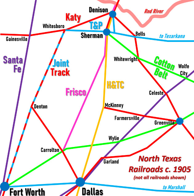
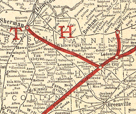
Louis Southwestern (SSW, "Cotton Belt") Railway. In the late 1880s, Gould's control over the Katy lapsed -- he was fired by its shareholders once they were able to organize a stockholders' meeting. The Texas Supreme Court voided MP's lease and the Katy resumed independence in 1891 under a Texas charter granted later that year. In 1890, a new railroad, the Sherman, Denison & Dallas Railway, was chartered to lay tracks from Denison to Sherman under a plan to build a better route for the Katy due south to Dallas (but the line was never extended to Dallas.) The T&P then built their own line to Denison from Sherman in 1896 under the charter of the Denison & Pacific Suburban Railroad. The tracks went eight miles north to Denison departing from the T&P main line three miles east of Sherman. The last major railroad to enter Sherman was the St. Louis & San Francisco ("Frisco") Railway c.1901. The Frisco had routes through Oklahoma and Missouri, and its President, B. F. Yoakum, decided to enter the north Texas market as part of a larger plan to compete with SP along the Gulf coast. With an agreement to share the Katy bridge over the Red River, the Frisco built south to Denison where they were able to negotiate a trackage rights agreement with the H&TC between Denison and Sherman. A Frisco-sponsored railroad, the Red River, Texas & Southern Railway, was chartered to build from Sherman to Fort Worth. Construction stopped in 1902 at Carrollton in north Dallas County where trackage rights on the Cotton Belt to Fort Worth were negotiated. Left: area map c.1905. In addition to Sherman, Dallas and Fort Worth, interlockers were eventually installed at Denison, Carrolton, Garland, Greenville, Celeste, Whitewright, Bells and Gainesville. |
|
Right:
Railway News, July 28, 1900 B. F. Yoakum was a native Texan who had risen from a track gang job on the International & Great Northern to become President of the Frisco in 1900 at age 41. As CEO of the Frisco in 1904, he was also named Chairman of the Executive Committee of the Chicago, Rock Island & Pacific, effectively its CEO. SP granted the Frisco rights on the H&TC between Denison and Sherman because SP knew it would benefit by carrying Frisco freight south from Dallas and Fort Worth to Houston despite Yoakum's plan to compete aggressively with SP along the Gulf coast, a story best told elsewhere. |
 |
By the early 1900s, there were tracks in Sherman owned by five major railroads: 1) the H&TC, which had come under SP control in 1883; 2) the Katy, which had service to St. Louis to complement its large network in Texas serving Dallas, Houston, Galveston, Waco and San Antonio; 3) the T&P, which operated northern and southern routes from Texarkana to Fort Worth continuing to El Paso, plus tracks from Marshall east into Louisiana; 4) the Cotton Belt, which had various lines from Texarkana to Sherman, Tyler, Waco, Dallas and Fort Worth; and 5) the Frisco, which had a significant route network in Oklahoma and Missouri, and which had begun expanding aggressively into Texas, already as far south as Brownwood.
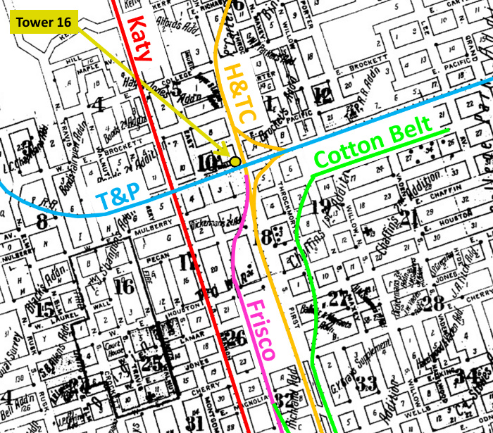
Above Left: This 1914 Sanborn
Fire Insurance Map of Sherman has been annotated to show the five railroads serving
Sherman. Tower 16 was located at the
H&TC / T&P crossing in the city's center. West of the tower, the Katy crossed the T&P within the T&P's
"yard limits", so no interlocker was necessary. The short green Cotton Belt line
connecting to the purple Frisco line at the bottom of the map was a spur that
allowed the Cotton Belt to reach its passenger station located along
Frisco's tracks at the corner of East and Lamar (about where the number "26"
appears on the map.) Above Right, Top: Tower 16 is shown as a "2"
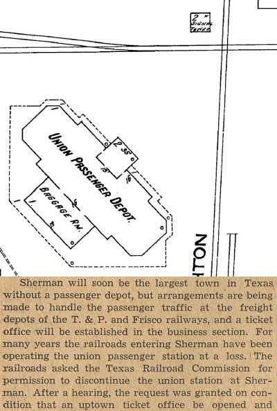
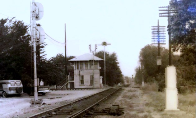
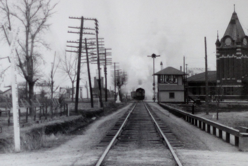
(two-story) "Signal Tower" on the 1914 Sanborn map. The tower was in the northwest corner of the crossing. Sherman's Union
Station sat across the T&P tracks south of Tower 16.
Above Right, Bottom: The
Whitewright Sun of July 15, 1943 reported
the Railroad Commission's approval for the railroads to abandon Sherman Union
Station. The station was demolished in 1944.
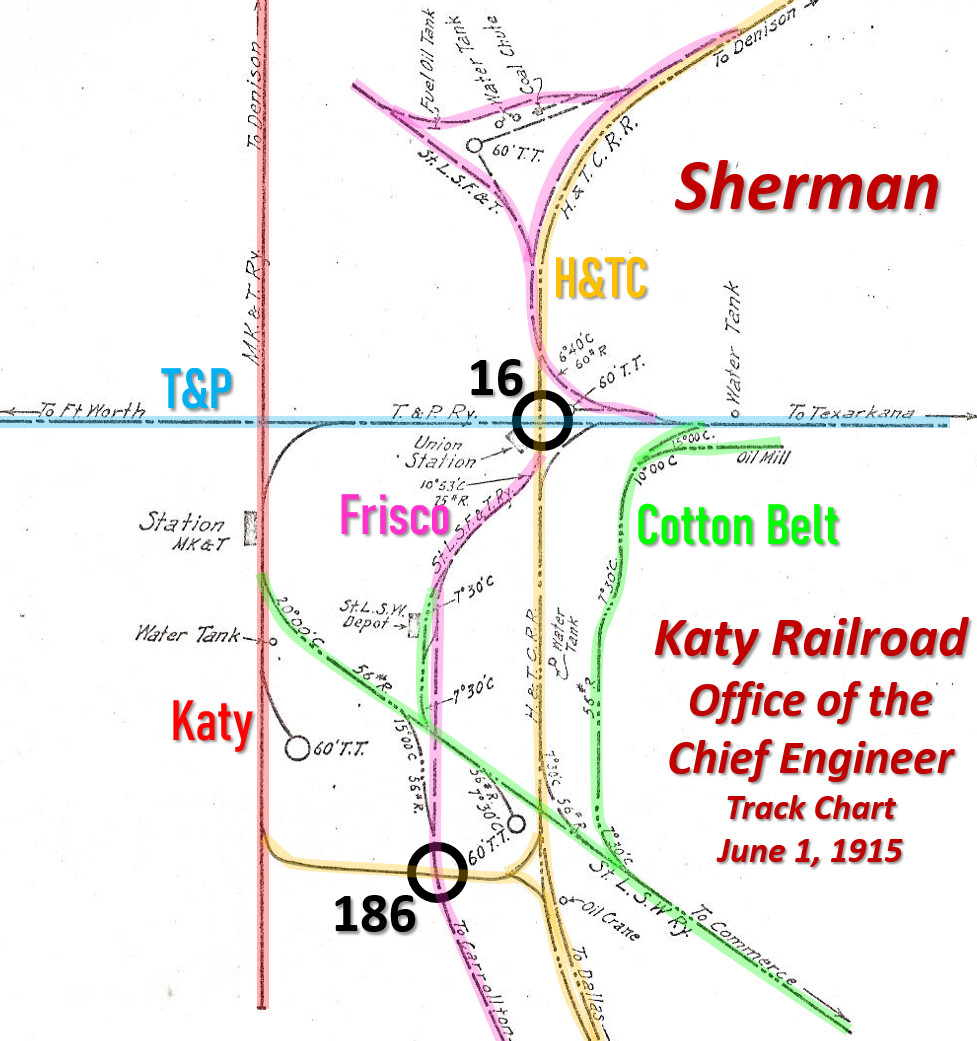
Above: This track chart (not
drawn to scale) produced by the Office of the Chief Engineer of the Katy
railroad has been annotated to highlight the railroads at Sherman as of June 1, 1915. The
map shows the Katy tracks terminating in south Sherman, but by 1922, the Sanborn
Fire Insurance map
shows the tracks making a 90-degree turn to the west for a couple of blocks to
serve the Sherman Manufacturing Co. The
Tower 16 and Tower 186 crossings are indicated as black circles. Tower 16 had been
operational since July, 1903 but the Tower 186 interlocker was in the
distant future, installed in the early 1940s. Among the
numerous grade crossings of railroads in Sherman, the Railroad Commission of
Texas only required these two locations to be interlocked.
The reason the Cotton Belt depot ("St.L.S.W. Depot" in the above image) was located along the tracks of the Frisco ("St.L.S.F.&T.Ry." in the above image) was because the Cotton Belt preceded the Frisco by more than a decade. These were the Cotton Belt tracks originally. Steve Goen explains...
"The tracks in front of the Cotton Belt depot were originally all Cotton Belt but at the point in time that the Frisco reached Sherman some type of agreement was reached in which the Frisco got off the SP, passed thru town on this trackage and then split again south of town. I suspect that ownership of the trackage may have passed to the Frisco at this time. The Frisco used Union Station as well as did the T&P and the SP. The SP bowed out first, ending passenger service on December 15, 1935. Both the T&P and Frisco continued to use Union Station until 1944 when they moved out and it was torn down. The T&P rebuilt their freight depot into a combination passenger station at that time and it remained open until July 6, 1950 when the Texarkana - Bonham - Ft. Worth trains came off. As for the Frisco, they did like the T&P and added passenger areas to their freight depot downtown. They did the same at Denison when they moved out of the Katy depot and started using their own freight depot."
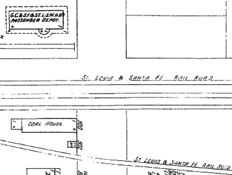
One of the largest route networks in Texas in the early 20th century belonged to the Atchison, Topeka & Santa Fe (AT&SF) Railway through its various Texas subsidiaries. Santa Fe never built tracks into Sherman, but they did serve Sherman for several years using rights negotiated with the Cotton Belt. Santa Fe's line from Dallas to Paris crossed the Cotton Belt in Wolfe City, less than 40 miles southeast of Sherman. (This crossing was never interlocked but it was eventually gated.) Santa Fe had made arrangements to use the Cotton Belt tracks from Wolfe City to Sherman at least at early as 1901. The 1901 edition of Poor's Manual of Railroads lists "Wolfe City to Sherman, Tex. (leased)" as a component of the Gulf, Colorado & Santa Fe (GC&SF) route network, while the 1908 Annual Report of the Railroad Commission of Texas (RCT) lists "Gulf, Colorado & Santa Fe, track of -- St. Louis Southwestern Railway of Texas, Wolfe City to Sherman" in a table of trackage rights. Both sources state the distance as 38.7 miles. Santa Fe's service to Sherman apparently did not last long. While the 1908 Sanborn Fire Insurance map of Sherman shows a joint GC&SF / Cotton Belt depot, the 1914 map no longer includes the GC&SF.
Above Left:
This image comes from a 1911 Santa Fe map that highlights all of GC&SF's routes
in Texas including the Wolfe City - Sherman segment over Cotton Belt
tracks (courtesy of Baylor University Digital Collections, hat tip Sam Myers.)
Above Right: The 1908 Sanborn Fire Insurance map of Sherman
labels the Cotton Belt depot as a joint "GC&SF & St.LSW RR Passenger Depot".
Note that the Frisco tracks are misidentified as "St. Louis & Santa Fe" instead
of "St. Louis & San Francisco."
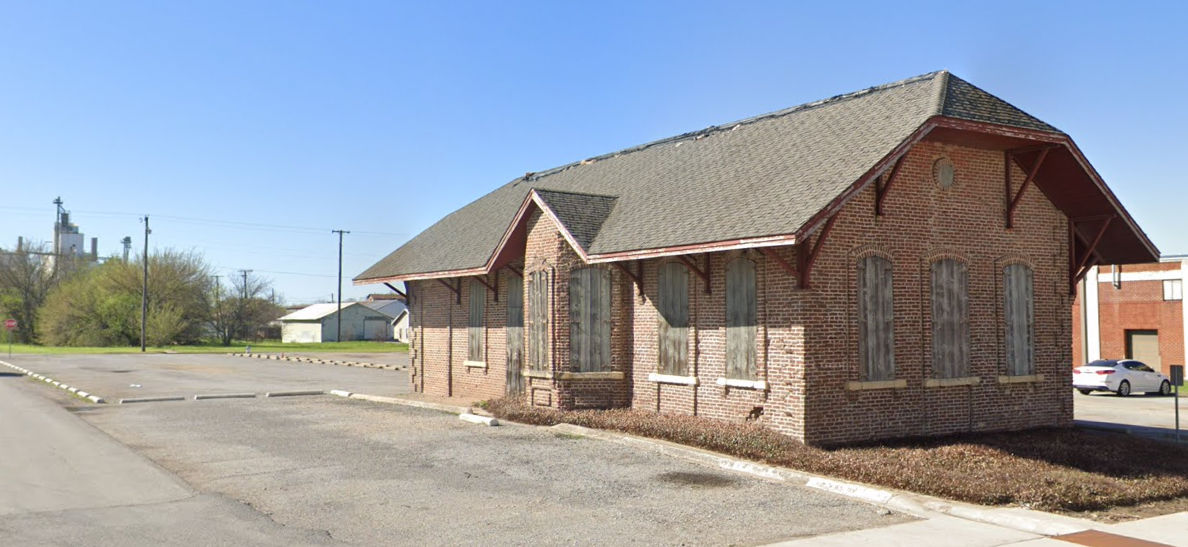
Below: a
March, 2023 Google Street View of the boarded up Cotton Belt depot in Sherman,
current disposition unknown
In 1927, SP began consolidating its Texas and Louisiana railroad holdings by leasing them to its Texas & New Orleans (T&NO) subsidiary. In 1934, they were merged into the T&NO and the H&TC ceased to exist. On April 14, 1932, SP received approval from the Interstate Commerce Commission to exercise operational control over the Cotton Belt. SP allowed the Cotton Belt to continue to operate under its own name and the Cotton Belt was never leased by nor merged into the T&NO. The T&NO was dissolved by SP in 1961 and all of its assets were merged into SP. In 1992, the Cotton Belt was merged into SP.
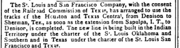
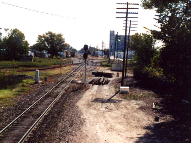
| From its initial construction into Denison c.1901, the Frisco used SP's tracks between Denison and Tower 16, and then switched onto the Frisco main line south of the tower to reach the depot and continue south to Carrolton (and from there to both Dallas and Fort Worth via Rock Island tracks through Irving.) At the depot, the Frisco main line was about 500 ft. west of the SP main line, but 1.7 miles farther south, the Frisco and SP tracks came very close, sharing a common right-of-way for about two miles. At the north end of this common right-of-way, a switch, Frisco Junction, was installed to allow Frisco trains to use SP's tracks. Frisco Employee Timetables (right top, September 1, 1963 and right bottom, August 9, 1964) narrow the timeframe in which Frisco Jct. was added. About 2.1 miles south of Frisco Jct., another switch was added to allow Frisco trains to reconnect to their main line to Carrollton. This switch became known as South Sherman Junction. The original Frisco main track between Frisco Jct. and South Sherman Jct. ran directly beside SP's tracks the entire distance and was abandoned. | 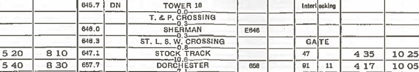 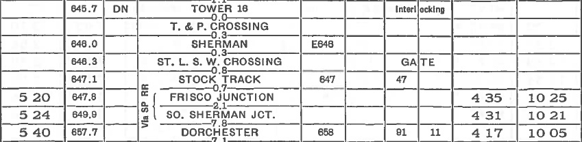 |
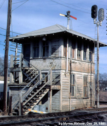
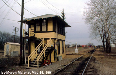
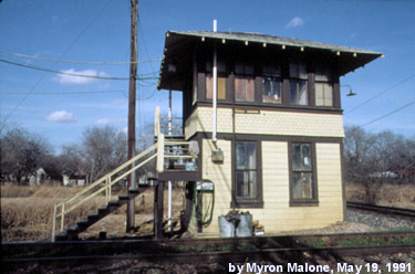
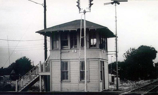
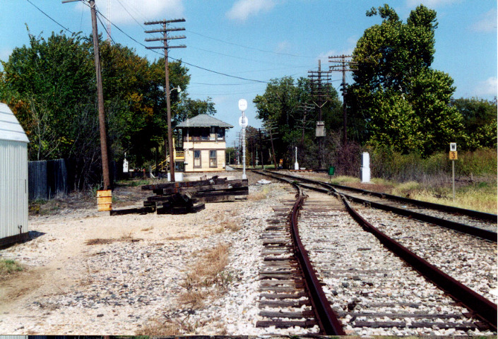
Despite the
sizable rail infrastructure in Sherman, only one major interlocker, Tower 16, was ever
commissioned, authorized for operation on July 18, 1903.
It was located in
central Sherman where it protected the crossing of T&P's east / west line and
H&TC's north / south line. Tower 16 was a standard SP design and was operated by SP
personnel for most of its history. Through the end of 1930, RCT's Annual Reports
included a table of active interlockers, and the first to include Tower 16 was dated
December 31, 1903. It reported the interlocker as an electrical plant with 35
functions and 31 levers built by the Taylor Signal Company, with the H&TC and
T&P listed as the railroads operating through Tower 16. The table published
the following year added the Frisco, which continued to be listed until it was
omitted from the table dated October 31, 1916. The Frisco was re-included beginning with the
table dated December 31, 1923 and the listing remained unchanged through the end
of 1930. That 1916 - 1923 timeframe overlaps with the period during which the
Frisco was in receivership, which may have impacted the Frisco's operations at
Tower 16.
Tower 16 continued to operate for nearly 100 years, but the
rail landscape in the Sherman / Denison area changed significantly over that
period. In 1925, Missouri Pacific (MP) acquired several Texas railroads and
resumed operating in state for the first time since its Katy lease had been
dissolved in 1891. By 1930, MP owned a large majority of T&P stock, but did not
exercise executive control until 1976 when it acquired the remaining stock and
absorbed the T&P's operations. In 1982, Union Pacific (UP) acquired MP, allowing
MP to continue to operate as a wholly-owned subsidiary. In 1988, UP bought the
Katy and merged it into MP. Since MP had also merged the T&P, this gave UP sole
ownership of the
Joint Track. The Katy's route from Denison to Gainesville and
Henrietta had been abandoned west of Whitesboro in
1970, and in 1992, UP abandoned its ex-T&P tracks between Sherman and
Whitesboro. Though no longer the Joint Track, it continues to carry
significant Denison - Fort Worth traffic for UP.
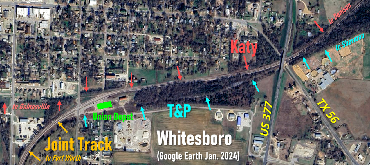
Above: This annotated Google Earth image shows the track
arrangement in Whitesboro. The Katy and T&P did not cross in Whitesboro, hence
there was never a numbered interlocker. Gould had directed the T&P to build the
Sherman - Fort Worth line through Whitesboro simply to provide the Katy with a
route to Fort Worth, which became the Joint Track. The proximity of the two
railroads facilitated construction of a union
depot.
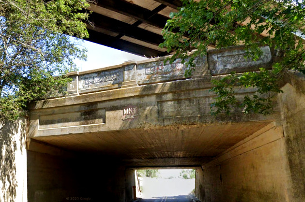
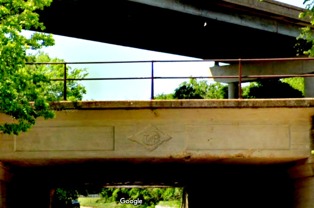
Below:
The TX 56 underpass beneath both railroads still shows their heralds: left, the Katy,
southbound on TX 56, and right, the T&P, northbound on TX 56.
Only the Katy line is still active. The bridge over the top is US 377. (Google Street View,
May 2023)
East of Sherman, most of the T&P's northern route
between Texarkana and Sherman has long been out of service or abandoned
entirely. The line ceased to serve a through traffic purpose and it had limited
on-line commerce with no major population centers. Tracks remain intact west
from Texarkana to serve the Red River
Army Depot near New Boston, but 38.5 miles of track between New Boston and Clarksville
was abandoned in 1996. Twelve miles of track out of Sherman are used for a connection at
Bells where a former Katy line from Denison to
Greenville once passed through town. The Katy was abandoned north of
Bells in 1988 and the junction was restructured to provide a continuous track
between Sherman and Greenville. This track is now operated by a short line
subsidiary of the Genesee & Wyoming
(G&W) Railroad. The tracks east of
Bells are generally intact to Bonham, but the line is out of service and only used for car
storage to a limited extent. The Bonham - Paris segment was formally abandoned
in 2003. The tracks mostly remain in place though they are generally buried in
pavement at grade crossings and substantially overgrown elsewhere. A T&P track
segment remains in use at Paris, which is still served from the north by a G&W
short line out of Hugo, Oklahoma on former Frisco trackage.
In 1980, Burlington Northern (BN) acquired the Frisco and inherited rights
on SP's line between Denison and South Sherman Junction. In the early 1990s, BN
acquired this track segment from SP. SP
departed the Sherman market entirely by also divesting its tracks south of South
Sherman Junction to McKinney. They are now operated by a short-line subsidiary
of G&W, but the line is severed south of McKinney. Since BN's acquisition
included the tracks past Tower 16, BN replaced SP as the Tower 16 operator. BN
subsequently merged with AT&SF to form Burlington Northern Santa Fe (BNSF) in
1996.
UP merged with SP in 1996 and soon
thereafter integrated UP, SP and MP operations under the common UP banner. With
the T&P abandoned west of Sherman and only limited operations east of Sherman to
Bells by a G&W short line, Tower 16 had outlived its purpose and was retired on
October 23, 2001. At the time, it controlled the BNSF line from the Red River
bridge to South Sherman Junction. Since there was limited east/west traffic across the diamond, BNSF received approval from Federal regulators to retire
the entire Tower 16 signal system under the condition that the diamond at Tower
16 be removed. To permit removal of the diamond, a new
connector track was installed in the northwest quadrant of the crossing. This
complemented the existing connector tracks in the northeast and southeast
quadrants.
Myron Malone explains the activities surrounding the closure of Tower 16...
"For about 2 months prior to closure, signal and construction gangs had been working in the Sherman/Denison area to prepare for the closure. On October 23, 2001, a signal and construction crew started work at 8:00am. They first removed the diamond adjacent to the tower. Next they placed a new switch into position just north of the tower, activating the new connector track. A little after 9:00am, they knocked down signal Number 4, still showing red when it went down. Signal Number 3 was next. Both signals had to be removed to make room for the switch at the new connector track. The switch machines remotely controlled by Tower 16 were replaced by hand throw switches. About 11:00am, a contractor began the process of boarding up the tower. By 3:00pm, when the second trick operator arrived for work, the tower was closed."
 |
 |
 |
 |
 |
 |
  |
 |
 |
 |
 |
 |
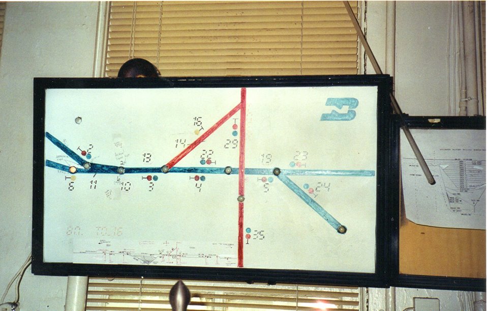
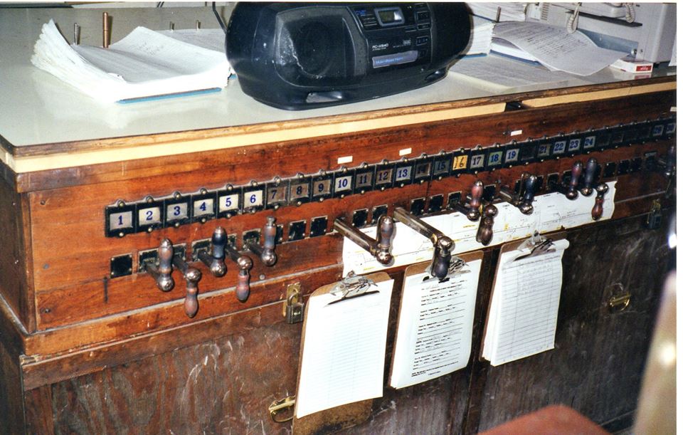
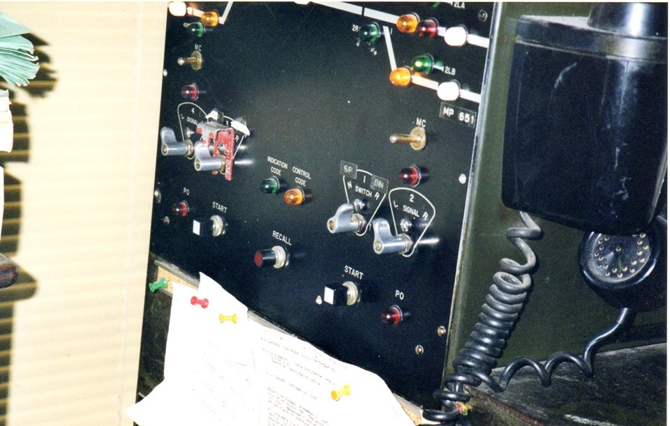
Tower 16 Interior Photos by Larry Paul
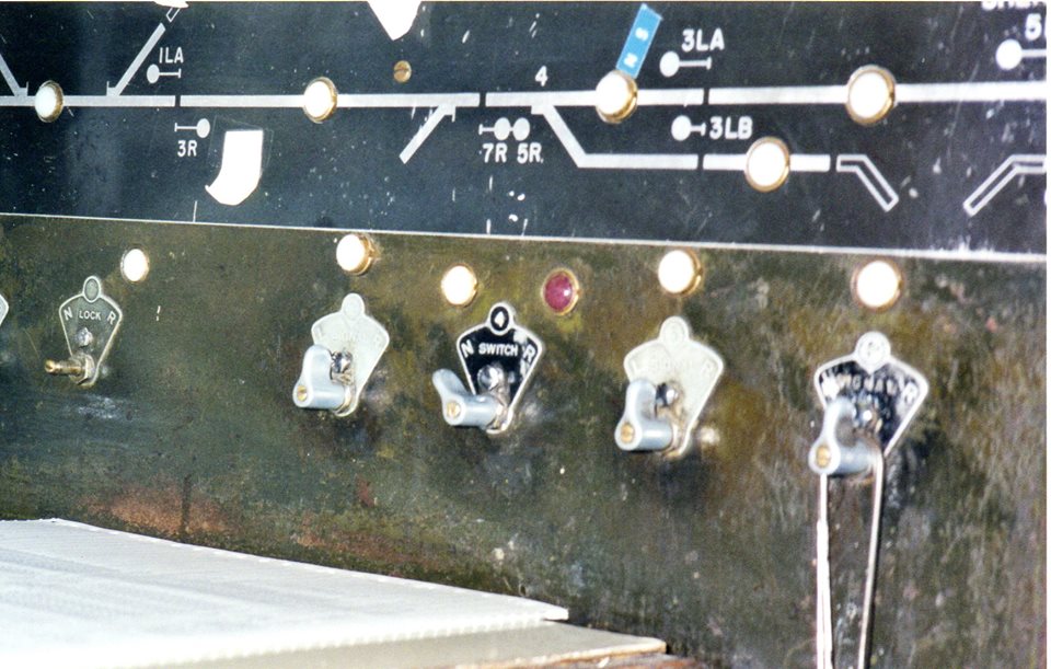
Tower 16 was relocated to the town of Grapevine near the Cotton Belt depot that serves as the Grapevine Visitor's Center. To relocate the tower, it was sliced horizontally between the floors and moved in two sections. It was reassembled and repainted, and now sits in a parking lot adjacent to the tracks at 709 South Main St.
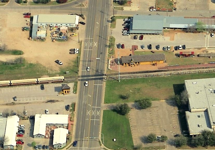
Above Left: This aerial
view shows Tower 16 in a parking lot of the Grapevine Vintage Railroad located on the southwest corner of the Main St. crossing of the
former Cotton Belt tracks.
The Cotton Belt depot is visible north of the tracks.
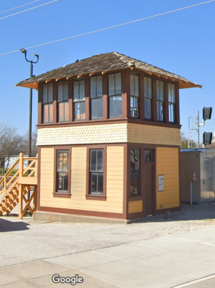
Above
Right: Tower 16 captured by Google Street View, February, 2024
In the early 1940s, RCT commissioned a second interlocker south of
downtown Sherman where a
short spur track owned by SP crossed the Frisco's main line (see 1915 track
chart above.) The interlocker was designated Tower 186 in RCT's numbering
system. The precise nature of the interlocker is unknown, most likely a
cabin interlocker or
ground lever interlocker,
definitely not a manned tower. The construction timeframe for this spur is
undetermined, but it likely would have been after 1890 when the Katy built its
Denison - Sherman line with plans to continue south to
Dallas (but the Dallas extension never materialized.)
The SP spur appears on the 1914 Sanborn Fire Insurance map
and is shown serving the Sherman Packing Co. slaughterhouse, a business also
served by the Katy. The spur also connected to the Katy to facilitate movements from
SP onto the Katy tracks northbound, and
movements from the southbound Katy onto the SP spur. There were spur leads
connecting to the SP main line in both directions, producing a triangle of
tracks in which SP built a large fuel storage facility. Did the presence of the
packing plant motivate the spur's construction or was the spur built simply to
make a connection to the Katy, thereby creating a prime industrial site served
by two railroads that the Sherman Packing Co. chose for
its slaughterhouse? The answer remains to be found. The Frisco main line through
south Sherman was built c.1902, but whether the spur already existed by then is undetermined.
Its location was not covered on Sanborn maps prior to 1914.
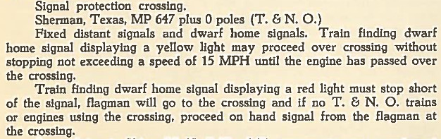 |
Left: This excerpt from a 1951 Frisco employee timetable discusses the T&NO (SP) crossing in south Sherman at milepost 647 (in 2002, Tom Greco reported the same information in a 1947 timetable, and a 1955 timetable also lists the T&NO crossing at MP 647.) The use of fixed distant signals (effectively caution signs) to warn Frisco trains they were nearing a restricted speed crossing indicates that this was not an automatic interlocker. The restricted speed limit (15 mph) allowed time for Frisco trains to stop when they encountered a red home signal. A cabin or ground lever interlocker would be operated by SP trainmen to set the Frisco dwarf signals red before proceeding across the diamond. When the crossing was complete, the dwarf signals would be returned to their yellow condition. Unfortunately, SP timetable information about this spur and interlocker has not been found. |
A Frisco Employee Timetable from 1963 no longer lists the T&NO crossing at MP 647. Thus, its retirement occurred in the 1955 - 1963 timeframe.
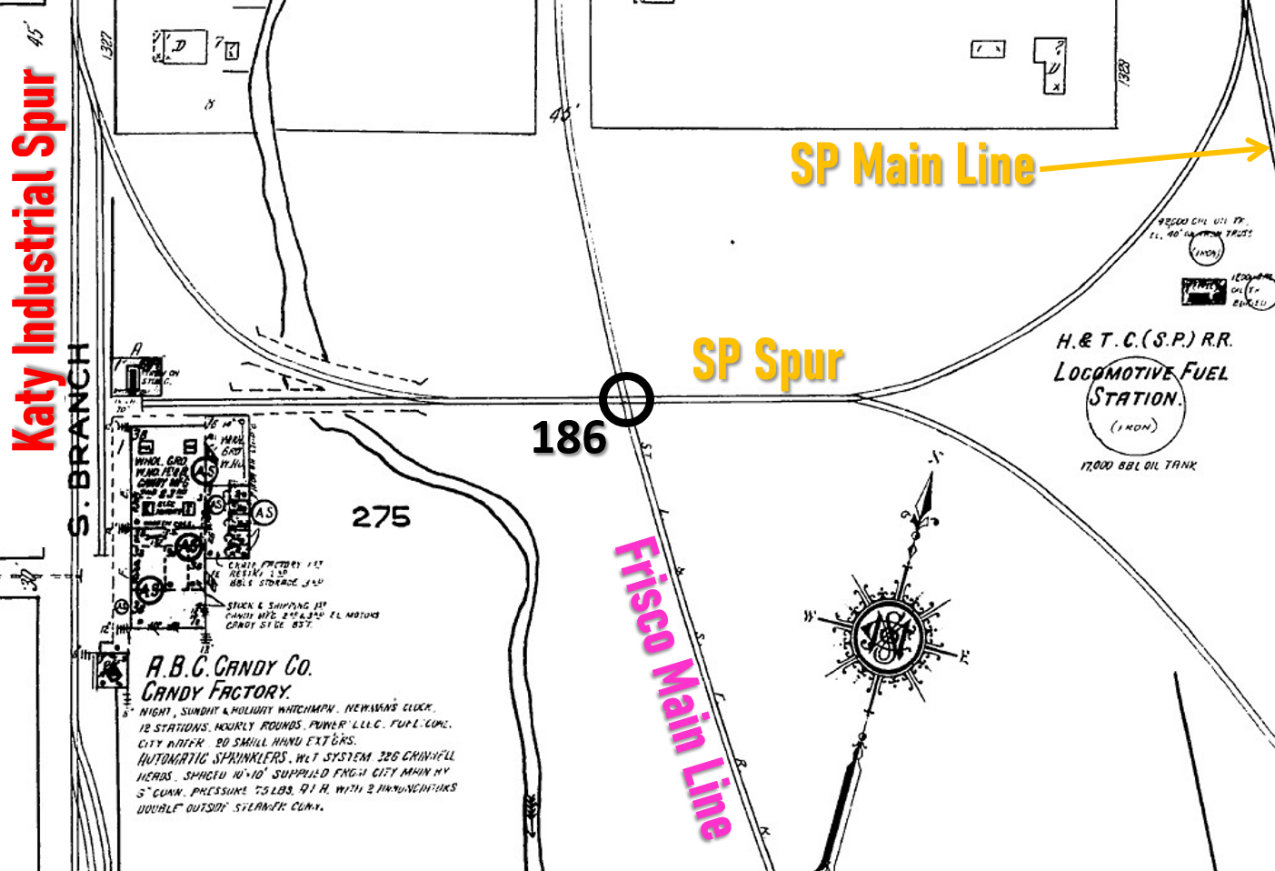 |
Left: This annotated
1922 Sanborn Fire Insurance map shows the Tower 186 crossing. A facility of the A. B. C. Candy Co. had replaced the
Sherman Packing Co. The drawing notes that "Automatic Sprinklers" with "326
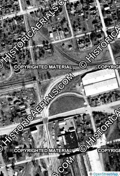
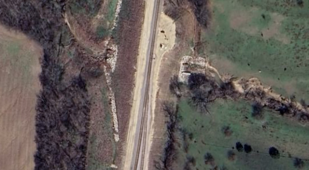
Grinnell heads" were in use at the factory.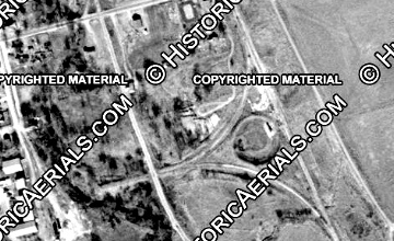 Above: 1958 ((c)historicaerials.com) 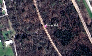 Above: March, 2023 (Google Earth) |
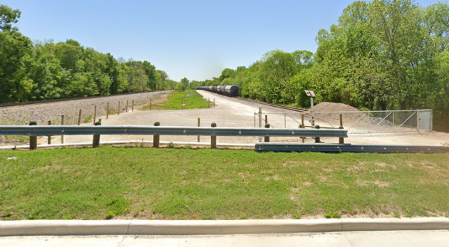
Above Left: This 2023 Google Street View looks south
from Park Ave., about 0.4 miles south of the site of Tower 186. The original Frisco main
line is severed here and still in use for car storage. It connects to BNSF's
main line -- originally the SP main line (at left) -- about 0.3 miles distant at
the original Frisco Jct.
Two miles farther south, the BNSF main line continues
through South Sherman Junction (above right)
where a switch now provides access to the former SP tracks toward McKinney. The
BNSF main curves briefly to a due west heading before resuming its southwesterly
trek to Carrolton.