Texas Railroad History - Tower 110 (Dayton) and Tower 148 (Fullerton)
Two Trunk Line Crossings of the
Trinity Valley & Northern Railway near Dayton
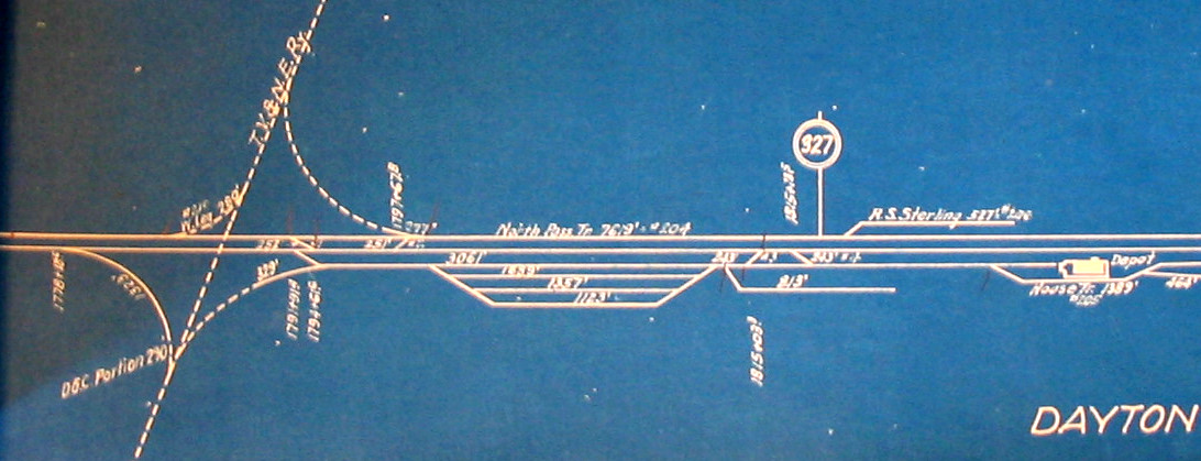
Above: This undated
(c.1920) linen track chart (collection of Bruce Blalock, Jim King photo, 2008) shows the main line of the Texas
& New Orleans Railway running generally east/west through Dayton. The Tower 110 junction west of the yard had Trinity Valley & Northern
rails going north and Dayton & Goose Creek rails going south, with connecting
tracks in all four quadrants. A drawing in the interlocker archives
of the Railroad Commission of Texas (maintained at
DeGolyer Library, Southern Methodist University) shows Tower 110 in the
southeast quadrant; the nearby connecting track was behind the tower. The T&NO
main line had two tracks, hence the abandonment of the tower in March, 1927
resulted in the removal of two diamonds, but the tracks in all directions
remained in place. The track to the north was abandoned c.1933, but the one to the south remains intact today as do both of the main line
tracks.
West of the town of Liberty across the Trinity
River, the community of West Liberty morphed into the town of Dayton ("Day Town"),
named for land owner, I. C. Day. By 1860, it was known as Dayton Station
on the Texas & New Orleans (T&NO) Railroad
between Houston and Beaumont.
The railroad had been chartered by a lumber company in 1856 for the purpose of connecting southeast
Texas with the port of Galveston. Three years later, the vision shifted toward establishing a rail line between Houston and New
Orleans. By 1860, tracks had been laid between Houston and
Orange, and as the Civil War commenced, the T&NO
briefly became a military supply line. The condition of the tracks deteriorated
quickly, and in the post-war years, there was only intermittent service on short
track segments. Eventually, the line was rehabilitated and reconstituted into a
new company under the T&NO name. The first post-war train between Houston and
Orange operated in November, 1876. In 1880, the T&NO commenced scheduled service
between Houston and New Orleans, making it attractive to Southern Pacific (SP).
SP was assembling a southern transcontinental route out of California, and it
purchased the
T&NO c.1881 to cover the segment between Houston and New Orleans. In the
late 1920s, T&NO became
the primary operating company into which SP's lines in Louisiana and Texas were
leased (1927) and then merged (1934.) With a main line transcontinental railroad
passing through town, Dayton prospered with commerce focused on agriculture
(mostly cotton and rice), oil production and lumber.
The Dayton Lumber
Company opened a sawmill at Ladd in 1906, a mile northwest of Dayton. To access its timber,
the company built tram roads into the nearby forests and immediately established the Trinity Valley & Northern
(TV&N) Railway as a tap line. A tap line was a
chartered and incorporated common carrier railroad owned by a lumber
company (and/or its closely related interests, e.g. management investors.) Tap
lines moved
logs inbound to the mill and wood products outbound to interchanges with
trunk line railroads. As common carriers, tap lines were allowed to operate as
regular railroads by charging the public for carrying passengers, packages, merchant freight,
etc., and
they could sign contracts to transport mail. Lumber trams provided
plant services to assist in lumber production whereas tap lines sold
transportation services to the public. This incentivized lumber
companies to create tap lines into which they would transfer portions of their tram operations, and they would do so for
debt rather than cash. The debt accounts would be repaid by profits
from tap line operations. As common carriers, tap lines also could receive
income from trunk lines through division rates (a percentage of the
total price paid by the end recipient of a shipment.) With lumber company and
tap line ownership often overlapping 90% or more, the entire enterprise
(lumber company plus tap line) would realize increased revenue compared to
simply selling lumber products.
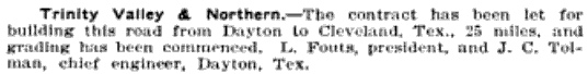 |
Left: The
Railway Age edition of June 29,
1906 carried this item regarding the contract (presumably with Dayton
Lumber Co.) to build the TV&N from
Dayton to Cleveland. That Cleveland was
listed in the charter as the TV&N's destination became potentially
valuable twenty years later. |
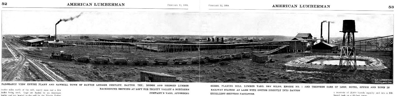
Above: An article in the
February 12, 1910 edition of American
Lumberman discussing the Dayton Lumber Co. notes that it had begun
construction of its sawmill in December, 1905 and had begun sawing logs in July,
1906. For this photograph, the barely legible
caption reads: "Panoramic view entire plant and sawmill town of Dayton
Lumber Company, Dayton, Tex.; rough and dressed lumber sheds, planing mill,
lumber yard, dry kilns, engine No. 1, and thirteen cars of logs; hotel, office
and town in background showing at left the Trinity Valley & Northern Railway
station at Ladd with switch directly into Dayton company's yard, affording
excellent shipping facilities."
In 1909, the Interstate Commerce Commission (ICC) began
an investigation into more than one hundred tap line railroads
in Texas, Arkansas, Louisiana and Mississippi to determine whether they were
complying with their common carrier obligations, specifically by
posting public tariffs and following them, and by handling passengers and
freight without discrimination. In particular, this required tap lines to charge
their lumber companies to move logs and finished products just as they would
charge any other sawmill. A hearing before
ICC examiners was held in St. Louis on January 23, 1911 at which the TV&N's
auditor, J. J. Balderach, was questioned. The
hearing transcript provides interesting details of the TV&N's history and
operations.
Since the ICC was trying to determine whether the TV&N
qualified as a bona fide common carrier, they eventually asked an obvious
question: Had the Railroad Commission of Texas (RCT) granted common carrier
status to the TV&N? RCT had been created by law in 1891, and from the outset
it had occasionally granted or denied common carrier status to railroads
in response to applications requesting such declaration. Recently, RCT had begun to
question their own authority to make such decisions, and their policy changed as
they considered TV&N's application. RCT's concern was based
on the fact that railroad charters were actual state laws, passed in the Texas
Legislature and signed by the Governor. Railroad companies with
state charters also subjected themselves to a myriad of state laws that governed how
railroads operated, including common carrier obligations. Railroads
were also subject to any
special provisions that might have been included in the laws establishing their charters. RCT was bound
by state law just as much as the railroads, and nothing in RCT's enabling
legislation mentioned the power to determine common carrier status. Thus its
Commissioners
had begun to question whether such declarations were legally ultra
vires ("beyond the powers").
 |
Mr. Balderach responded to the ICC examiner's question by reading
an order received in response to TV&N's 1909 application to RCT
requesting a common carrier declaration. Early in
the order, RCT succinctly spells out their revised policy (which had garnered
two votes of the three-person Commission):
The Railroad Commission is given no
authority to determine when railroad companies are common carriers. On the
contrary, the law itself fixes the status of such companies, and does this
absolutely without reference to the judgment or opinion of the Commission. Every
railroad company organized under the laws of Texas has the right to construct
and operate a railroad and are declared to be public highways and all railroad
companies common carriers. A railroad company having a Texas charter and owning
a Texas line is a common carrier by force of the statute, and it is its duty to
operate its road as a common carrier, complying with the laws of the State
regulating such carriers, and obeying and conforming to the authorized rates,
rules and regulations of the State Railroad Commission.
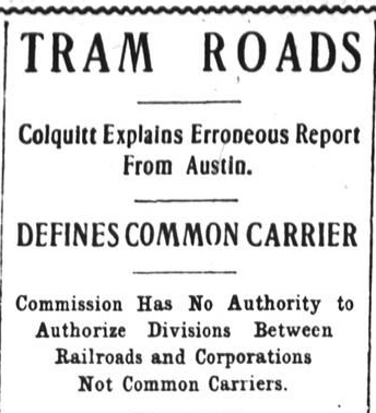
Left: It was
the TV&N's request for common carrier declaration that triggered the change in policy that had been
contemplated by two of the Commissioners. This was big news, and RCT's order
to TV&N was printed in the Houston Post
of June 26, 1909. It had been included in a letter to the newspaper from Commissioner
O. B. Colquitt (who would be elected Governor in 1910)
wherein Colquitt took issue with a report out of Austin claiming that RCT had
made a "...ruling permitting tram roads to become common carriers on the
filing of their charters." Colquitt explained that the erroneous article
"...grew out of a misunderstanding on the part of the reporter on the
meaning of what was done and said." He proceeded to cite various
obligations of common carrier passenger services that were beyond the
means of a typical tram road. These included running a passenger train
over the entire line at least daily (except Sunday), providing
comfortable "heated and lighted" passenger depots, and complying with
various crew and service hour laws applicable to passenger trains.
|
Under the new policy, Texas companies chartered by
state law as railroads automatically qualified as common carriers for
intrastate traffic. They could, however, forfeit their charters through judicial
proceedings if they did not comply with the legal obligations inherent to all
Texas railroads. Initially, tap lines had sought RCT's common
carrier blessing because it allowed them to derive revenue from moving
passengers and freight beyond that of the lumber company, and because it lent credibility to their efforts to seek
division rates from the ICC for
interstate traffic (where RCT had no jurisdiction.)
Under the new policy, tap lines in Texas could begin providing transportation
services to the public without the need for RCT's blessing and they could
request ICC approval for division rates. They could
not, however, establish division rates for intrastate
traffic without permission as such rate-setting was exclusively
within RCT's purview. In the Houston Post
article referenced above, the bottom sub-headline asserts that to whatever
extent RCT had ever authorized division rates between trunk line railroads and
lumber trams (or other private rail lines, e.g. sugar
plantations), those days were over.
The ICC ruling was issued in April and May, 1912,
presenting their analysis of each railroad and their findings that thirty-six of
them did not qualify as common carriers. In its
summary ruling (courtesy Texas Transportation
Archive) the ICC did not object to the TV&N's common carrier
claim, but it did set a limit of one cent per hundred pounds that the TV&N could
receive from a trunk line on interchanged freight. Collectively, the railroads
appealed to the Supreme Court, which remanded the case to the ICC for revision
in light of legal standards made plain by the Court. The initial ICC ruling had
in most cases concluded that a tap line converted from long-existing tram lines and
still largely owned by the same lumber company was per se
not a common carrier (perhaps favoring the
TV&N, which had been chartered as soon as the lumber company began sawing logs.) The Supreme Court overruled the ICC, requiring a
substantially greater and individualized inquiry into each tap line's
operations. Industry observers viewed it as a loss for the ICC, but ultimately,
the most deficient tap lines either increased their compliance with ICC
regulations or reverted
to tram status. In response to the remand, the ICC
began to focus on establishing a settled regulatory environment in which tap
lines had clear rules under which they could operate.
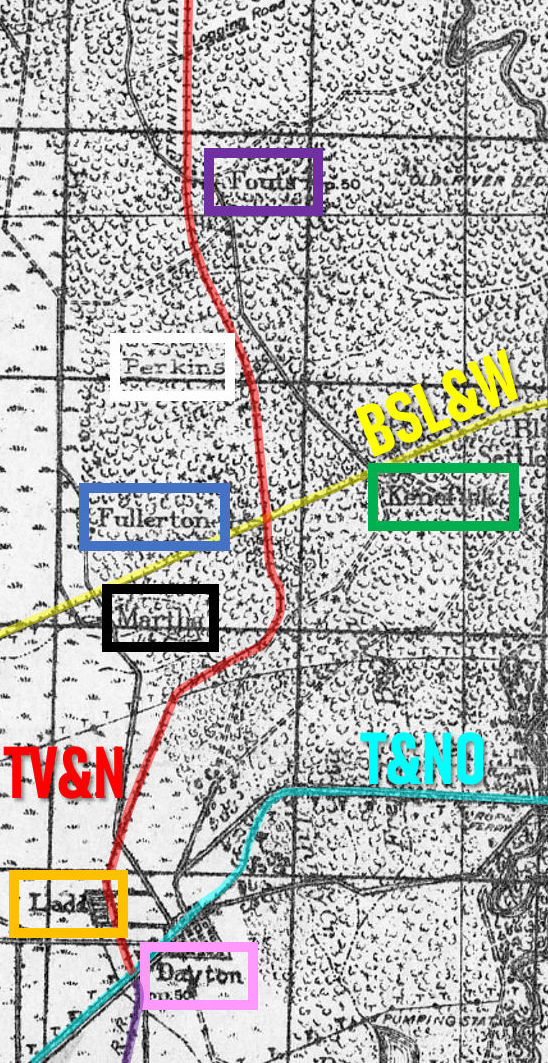 |
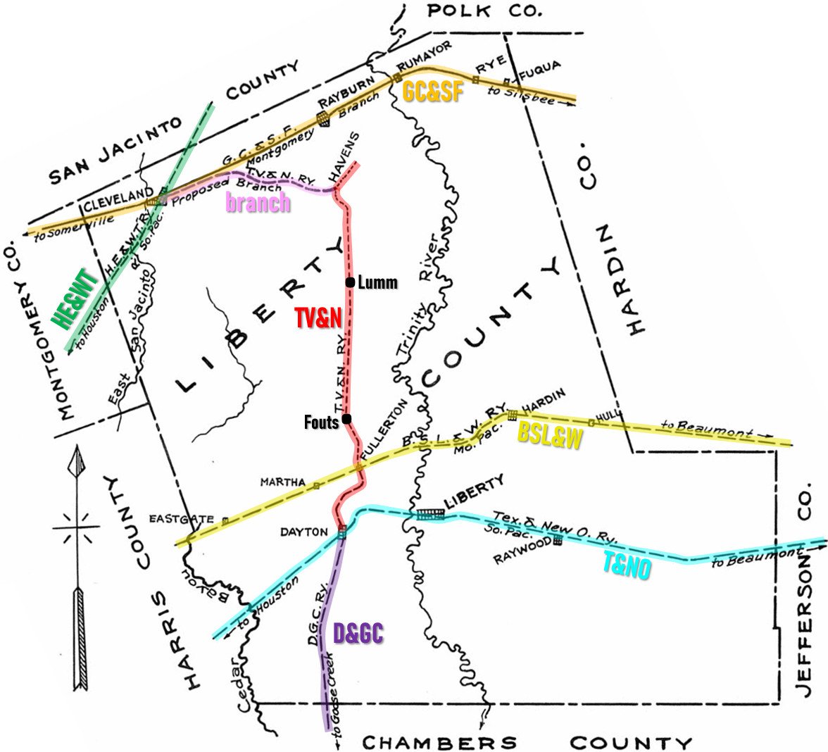
Left:
This image has been edited from a U. S. Army Corps of Engineers
topographic map and annotated to show the route of the TV&N (red line)
north from Dayton (pink). By the map date of 1922, the TV&N
connected to the Dayton & Goose Creek Railway (purple line) on the south
side of the T&NO main line (light blue). The mill at Ladd
(orange) was about a mile northwest of the crossing, and was the
maintenance base for the TV&N. Farther north at Fullerton (blue), the
TV&N crossed the Beaumont, Sour Lake & Western (BSL&W, yellow line), a
component of a large
network known as the Gulf Coast Lines. Whether Fullerton was ever more than a rail junction, it no longer exists. Farther north, the TV&N
passed through Perkins (white) and Fouts (purple). Fouts was
a logging camp and Perkins may also have been, but neither survives today. Kenefick
(green) remains a town whereas Martha (black) at the BSL&W crossing of
the main road toward Cleveland
is only a historical location.
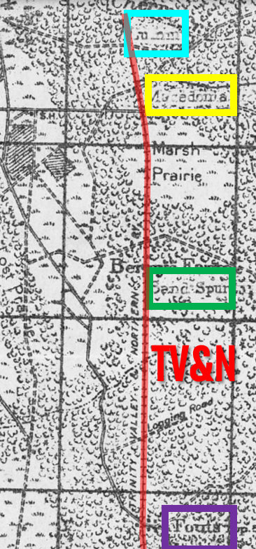
Right: A continuation of the map north of Fouts
shows the TV&N proceeding to Lumm (light blue), the end of the line. Near Lumm,
the TV&N passed through Macedonia (yellow), a settlement founded by a
Chicago syndicate in 1914 as a community of Greek
farmers to raise vegetable crops for market. The community foundered and
lost its Post Office in 1922. Sand Spur (green) appears on a 1923 TV&N
passenger service timetable; it may have been a logging camp but no
longer exists. The communities of Macedonia and Lumm did not survive the
abandonment of the TV&N in 1933.
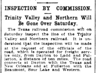
Below Right: In 1909 when TV&N issued its
request to RCT for a declaration of common carrier status, RCT responded
by scheduling an inspection. This was standard procedure and
the decision by the two Commissioners to change the policy regarding
common carrier declarations had not yet been made. The
Houston Post of Friday, May 7, 1909
carried this news item noting that the inspection would take place the
following day, and presumably it did. Seven weeks later, the
Houston Post would carry the
article in which Commissioner Colquitt's letter to TV&N was printed,
announcing RCT's position that such declarations were not necessary (and
never had been) because all chartered railroads in Texas held the legal
obligation to function as common carriers. |
 |
At Fullerton, the TV&N
crossed the Beaumont, Sour Lake & Western (BSL&W), a railroad founded in 1904 to
bring oil into Beaumont from the Sour Lake field. By 1905, its line to Beaumont from
Grayburg (about thirty miles east of Fullerton) had
become a tempting target for B. F. Yoakum, a native Texan with a long history in
Texas railroading who had become Chairman of the St. Louis - San Francisco
("Frisco") Railway. Yoakum wanted to compete with SP along the Gulf
coast by establishing a rail network centered on Houston,
an enterprise he called the Gulf Coast Lines (GCL). Yoakum assembled
the GCL by
chartering, building and buying railroads as necessary to connect Brownsville
with New Orleans. The St. Louis Trust Co. provided the financing for the GCL
resulting in an unusual situation; its individual railroads were
managed by Yoakum and his team of Frisco executives, but the Frisco corporation
did not own the GCL. It was essentially a marketing and operations consortium
with Yoakum calling the shots. The GCL's railroads were owned individually
through a syndicate backed by the St. Louis Trust Co. The BSL&W's Beaumont - Grayburg tracks and its Texas railroad charter gave Yoakum a head start on
building the connection his GCL needed between Beaumont and Houston. Yoakum acquired
control of the BSL&W in 1905 and extended it west to Houston, passing
through Fullerton c.1907-08. Whether the TV&N or BSL&W arrived there first is
undetermined, but they were close in time. During the Frisco's 1914
receivership, the GCL continued to operate, but its railroads were reorganized
under an independent corporation, the New Orleans, Texas & Mexico Railway,
created to provide executive-level governance.
Fullerton was named for S.
H. Fullerton, a well known investor and business executive of St. Louis who
probably had some (undetermined) connection with the Frisco and/or the
St. Louis Trust Co. Fullerton had large investments in lumber, coal and
railroads, and he owned fifty shares of TV&N stock. Though it was a small
investment, Fullerton was sufficiently interested in the TV&N to be present at
the ICC hearing held in St. Louis in January, 1911. As the ICC examiner probed
Mr. Balderach on whether Mr. Fullerton or any of his companies held an ownership
share of the Dayton Lumber Co., someone interjected "Mr. Fullerton is here
and he can tell you."
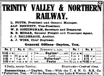 |
Left: This TV&N
timetable from the 1910 edition of
The Official Guide of the Railways and Steam
Navigation shows passenger service into Dayton at 8:20 am
with a footnote regarding the T&NO connection, presumably made at the
T&NO depot.
A
Houston Post article on September 1,
1910 also mentions the TV&N "...connecting at Dayton with Southern
Pacific trains." The clear implication from the timetable and the
article is that in 1910, the TV&N had a crossing of the T&NO main line
for the purpose of reaching the Dayton passenger depot on the south side of the tracks. The ICC
Valuation Report for the TV&N (as of 1919) lists only "rails and fasteners"
under lease from the T&NO; depot access is not mentioned, but it might
have been granted without a lease. [The decision to lease rails and
spikes from the T&NO benefitted both railroads: the T&NO, by employing a
relatively small amount of its excess rail inventory to help the TV&N
generate valuable outgoing freight interchanges, and the TV&N, because
leasing was less expensive.] The main line crossing depicted on the
linen track chart (top of page) is not known to have existed until
construction of the Dayton & Goose Creek railroad and the commissioning
of Tower 110 in 1918. If an earlier uncontrolled crossing existed for
depot access, it would tend to explain why RCT lists the T&NO and TV&N
as the only railroads involved with Tower 110. But if the TV&N did build
across the main line to reach the T&NO depot c.1910, the connection does
not appear to have survived the implementation of the Tower 110
crossing. The linen track chart does not show a direct connection,
although it was still feasible to reach the depot using reverse moves on
the D&GC main line and connector. |
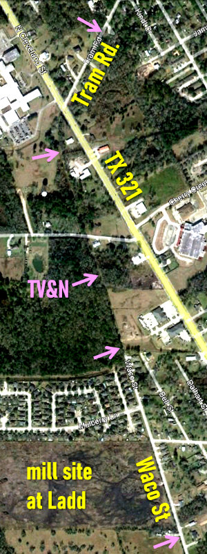
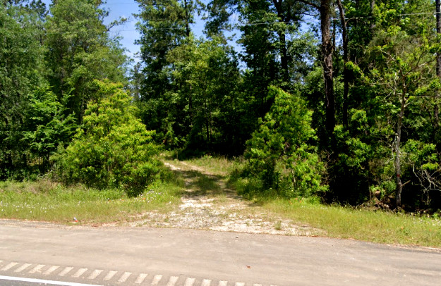
Above Left: In the vicinity
of Dayton north of Farm Rd 1960, Waco St. sits atop the TV&N right-of-way past the mill site at Ladd
to the end of pavement. The right-of-way continues another half mile where it turns northeast to cross State Highway 321 onto Tram Rd. After another half mile,
Tram Rd. ends but the TV&N right-of-way remains visible into the woods.
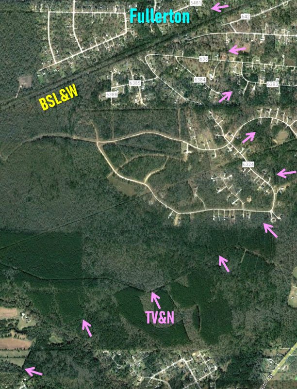
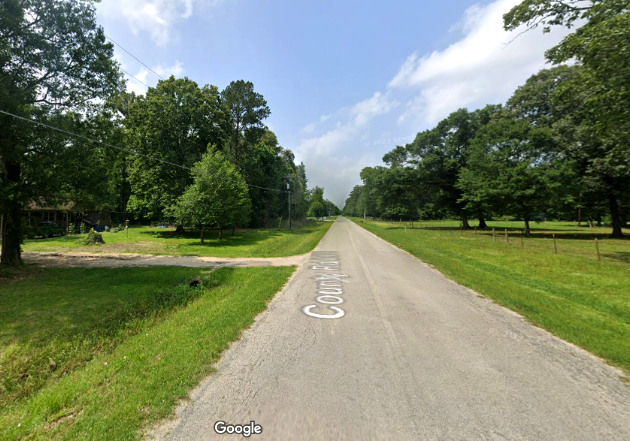
Above Center: The right-of-way
continues on the 27-degree Tram Rd. alignment into the woods and curves eastward
onto a 68 degree heading for 1.4 miles. It then curves
north to become occupied by 600 ft. of County Road 6324 in a residential area.
From there, it curves slightly west and takes a generally north-northwest
heading following the Bowie Creek drainage. It crosses the former BSL&W tracks just beyond the west end
"loop" of Parker Loop Rd.
(County Rd. 642.) Fullerton is no longer referenced
on maps, if it ever was; the vicinity is now a rural residential area west of Kenefick.
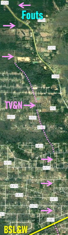
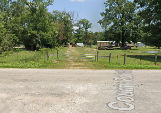
Above Right: About 200
yards north of the BSL&W crossing, the TV&N right-of-way becomes occupied by
County Road 6473 running due north for three quarters of a mile to its
intersection with Cumberland Rd. The road ends but the right-of-way continues
due north for another half-mile and then begins
a very long radius curve over the next mile where it assumes a north-northwest
333-degree heading. The alignment shifts to a 340-degree heading for 0.3 miles and
then almost due north for 0.8 miles to reach Farm Rd 1008 where Fouts was
located.
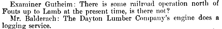
The TV&N's course
beyond Fouts was essentially due north. The TV&N opened the line to Lumm in
1911, but testimony at the ICC hearing early that year revealed that the Dayton
Lumber Co. had already been operating along the right-of-way for at least a
year, most likely using primitive roadbeds and temporary rails for hauling logs to Fouts
to be interchanged with the TV&N.
The tram tracks to Lumm were upgraded in sections by the lumber company to
the TV&N's standards and the sale was conveyed by adding to the debt account. Between Macedonia and Lumm, the grade
ran directly beside (west of) County Road 2309, but elsewhere, only a few dirt
road segments follow the route. The right-of-way between Fouts and Lumm is readily apparent on
satellite imagery, and it noticeably extends north of Lumm a few miles, crossing
State Highway 105 and eventually becoming occupied by County Road 2185. This is in the direction of Lamb, a station on the Santa Fe
line (now called Hightower) east of Cleveland to which the TV&N had
completed a preliminary survey according to Mr. Balderach's testimony.
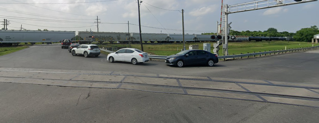
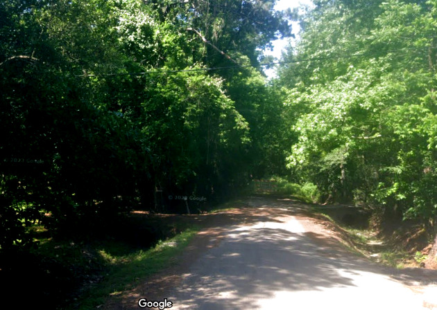
Above: Google Street View
provides glimpses of the tram line crossing of TX 105 looking south (left)
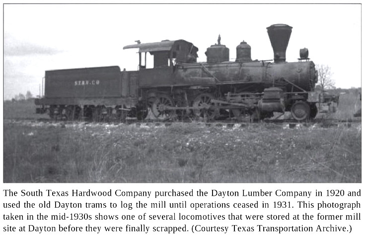
and north (right). Although
Mr. Balderach's testimony states that a survey to Lamb had been performed, it is
likely that the actual extension of the tram line north of Lumm -- which
produced this TX 105 crossing -- was done by the South Texas Hardwood Co. in the
1920s.
In
1912, Dayton Lumber Co. defaulted on loans, resulting in a takeover by a group
of creditors. The creditors continued to operate the mill at Ladd, changing its
name to Dayton Mills in 1915. Whether Ross S. Sterling, one of the founders of
the Dayton Lumber Company (and the TV&N) was still involved is undetermined, but
if so, he was unlikely to be paying much attention. Sterling was surely focused
on the oil company he and three others had founded in 1911, Humble Oil Co., with
Sterling as President. Five years later, the Goose Creek oil field south of
Dayton was proven with a 10,000 barrel-per-day well in August, 1916. This
undoubtedly played a role in Sterling's decision to have Humble Oil build a major refinery
near the oil field, along the Upper San Jacinto Bay outlet of the Houston Ship
Channel which had opened officially in 1914.
As construction of the refinery commenced, the company changed its name to
Humble Oil and Refining Co.
To support building the refinery and
shipping its products, plus the need to ship oil directly from the field to
other refineries, Sterling personally founded (and owned virtually all of) the
Dayton and Goose Creek (D&GC) Railway on July 24, 1917. Important though it was,
founding the D&GC was not the
peak of Sterling's career. Sterling sold out of Humble Oil (long before it
became Exxon), went into the real estate business, bought and merged the
Houston Post and
Houston Dispatch, became Chairman of the Texas
Highway Commission, was elected Governor of Texas in
1930 (serving from January, 1931 to January, 1933), founded an investment
company and another oil company, became President of American Maid Flour Mills,
and was named Chairman of the Houston National Bank. He used his spare time (?)
focusing on philanthropy.
The D&GC promptly began construction of a
23-mile line from Dayton south to the Goose Creek field. Carrying oil and
refined products to both the T&NO and BSL&W connections at Dayton and Fullerton,
respectively, was an important aspect of the plan. Reaching Fullerton required
the D&GC and the TV&N to connect at Dayton, which meant that a crossing of the
T&NO was necessary. To whatever extent a crossing may have existed for TV&N
passenger trains to reach the T&NO depot, it was clear that it would need to be
rebuilt to account for heavier and longer trains, additional connecting tracks,
an interlocking tower, and a wye north of the T&NO so that D&GC locomotives
could be positioned properly when exchanging railcars. The interlocking plant
was ordered by T&NO in November, 1917 and service to Goose Creek commenced May
1, 1918. Seven months later, Tower 110 was commissioned by RCT to control the
Dayton crossing. By 1919, the D&GC had been extended 2.5 miles farther south to
serve the Humble Oil refinery under construction at
Baytown.
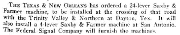 |
Left:
Tower 110's 24-lever mechanical plant built by Saxby & Farmer was ordered by
T&NO in the fall of 1917. It was commissioned December 18, 1918 and appeared
in RCT's annual list of active interlockers dated December 31, 1918. The
list shows Tower 110 having 18
functions, a size indicating control of connecting track switches and signals. Like this article from the November, 1917 issue of
Railway Signal Engineer, RCT lists the TV&N as the railroad that crossed the T&NO at Tower 110. |
RCT records show that T&NO staffed Tower 110's
operations (and almost certainly its maintenance as well.) No photo of Tower 110
has been found, and it does not appear on Sanborn Fire Insurance maps of Dayton; it was too far west.
The ICC's Valuation Report for the D&GC
states that the tower was owned by T&NO and leased to D&GC for 50% of the cost
of operation. RCT interlocking records reflect track ownership (TV&N) at the
crossing, but the ICC reports reflect operations, i.e. the D&GC and T&NO were
splitting the sustaining costs for the interlocking since they were the operational
participants, even though D&GC was not listed in annual RCT interlocker
reports.
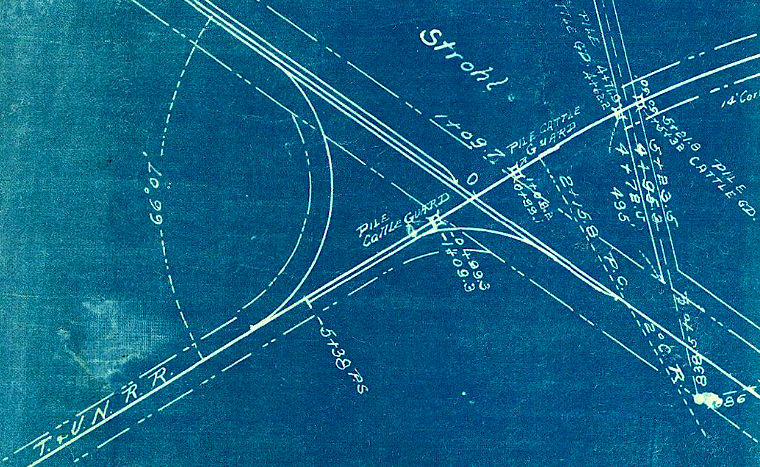 |
Left: This snippet
from a 1917 D&GC map (courtesy Texas General Land Office) shows
the initial plan for the Tower 110 crossing at Dayton (incorporating
four "pile cattle guards" !) The map was drawn with the intent of having
the D&GC tracks generally depicted horizontally so that the connections
to companion maps would be along the right edge of the drawing.
This resulted with North being toward the lower left corner (where
"T&VN" is mistakenly labeled instead of "TV&N" ). The map shows the D&GC
without connecting tracks to the T&NO; its only connection is directly
to the TV&N. This seems odd, but by the date of the ICC's preliminary
valuation for the D&GC (December 31, 1920), the D&GC and T&NO had built
1.5 miles of "...yard tracks and sidings at Dayton." These
tracks were "owned
equally and used jointly..." and presumably included the tracks east and west of the D&GC that appear on the
linen track chart. The oval directly above the two crossing diamonds (in what is actually the southeast
quadrant) likely represents the planned interlocking that became Tower
110.
A 1920 track chart shows a "Dayton & Goose Creek Wye" north of Tower
110, going east off the TV&N main line a short distance south of Ladd.
This suggests that a D&GC locomotive would bring its oil train through
Tower 110, decouple from the train and move onto the wye track. A TV&N
locomotive would back down from Ladd to connect to the train and take it
north to Fullerton while the D&GC locomotive turned around using the wye
and either waited for the return train or went back south to Baytown. |
|
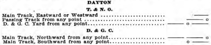
Right:
SP's Beaumont -
Galveston Division Timetable
of December 5, 1920 shows whistle codes for T&NO and D&GC locomotives to
request tower operators to set switches and signals for movements. The
implication is that the tower was manned and most likely two stories. It was near a busy T&NO yard and
had codes for both railroads; operators would need the elevation
for good visibility in all directions. An earlier March 1, 1920 T&NO timetable
lists the TV&N as the other railroad, the only TV&N code governs main track movements, and the
third T&NO code is for "West End Stock Pen Track". Why did
the whistle codes change between March and December? Perhaps the D&GC
connectors were built in this timeframe. |
 |
There is no doubt that T&NO built Tower 110, hence it
undoubtedly resembled other SP towers in Texas, e.g.
Tower 26 and Tower 115, which opened,
respectively, well
before and well after Tower 110. All SP towers in Texas were two stories and all carried an
architectural
resemblance. Since the construction of the D&GC created the need for the
interlocker, D&GC (perhaps
through TV&N's books) would have paid the entire capital cost of the tower (it
was a post-1901 crossing; capital expenses for interlockers at pre-1901 crossings were shared
equally.)
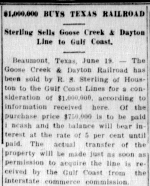 |
Left: In June,
1922, Sterling sold the D&GC for a million dollars to the GCL. (Bay City Daily Tribune,
June 19, 1922)
The GCL operated independently after
the corporate entity was established during the Frisco's receivership.
When D&GC began shipping oil through the Fullerton connection in
late 1918,
the GCL undoubtedly realized rather quickly that they would come out ahead if they simply acquired
the D&GC. Although shares of the BSL&W's
revenue for each oil shipment through Fullerton were taken by both TV&N
and D&GC based on division rates, TV&N's share was tiny whereas D&GC
originated the shipments and had a longer haul. D&GC was, however,
only a small part of Sterling's wealth and he had larger endeavors on
which to focus. His decision to sell may also have been impacted
by the Transportation Act of 1920 and the lawsuit he initiated against
it. The Act terminated the U. S. Railroad Administration's control
of the railroads that had been in place during the World War, but it contained a
controversial provision, the Recapture Clause, authorizing the ICC to
set a fair rate of return for railroads and mandating that the ICC
"recapture" half of any excess profits. As Time
magazine explained (January 21, 1924)... "The moneys received by the
Government under this provision of the Act are placed in a fund from which loans
are made and equipment leased to railways, the purpose being to bolster up the
weaker roads with part of the excess earnings of the stronger roads."
The
D&GC line to Baytown had been so profitable that it had nearly paid for
itself in only a few years. As a result, D&GC was
required to remit "excess profits" earned in 1921 (and in
future years) to the Federal
government. D&GC sued in Federal Court for the Eastern District of
Texas claiming that the recapture was an unconstitutional taking of
private property (the "excess profit") in violation of the Fifth Amendment.
The D&GC lawsuit was joined by nineteen other railroads and taken all
the way to the U. S. Supreme Court. The Court ruled unanimously against
the railroads on January 7, 1924. |
Long before the Supreme Court ruling, Sterling had
received more bad news -- the ICC had rejected Sterling's proposed sale to the
GCL. The ICC's rationale was that the price was "greatly
in excess of the value of the physical property involved" and that
the motivation for the high price was simply "to secure a larger
proportion of the traffic". The ICC did not view the price as
reasonable nor the sale to be in the public interest, much to the
surprise of railroad industry observers. Subsequently, the value of the D&GC
physical plant rose substantially. In 1926, Sterling proposed to sell the
D&GC to SP for $900,000 and the ICC approved. SP promptly conveyed
the D&GC to the T&NO and it became fully integrated into T&NO
operations.
With its newly acquired line to Baytown, T&NO could now
prefer its own network for oil and refinery traffic, eliminating the movements through
Fullerton. Since the BSL&W line through Fullerton and the T&NO line through
Dayton both went to Houston and Beaumont, railcars could be transferred to the
BSL&W at those points if necessary rather than Fullerton. This hit the TV&N hard as it had derived steady revenue from carrying
oil shipments on its tracks. With oil traffic no longer moving through
Fullerton, the primary need for Tower 110 was eliminated. RCT files show that
the tower was authorized for abandonment on October 18, 1926, and was actually
removed from service on March 18, 1927. It seems likely that T&NO simply removed
the TV&N diamonds, retaining the connecting tracks while closing the tower.
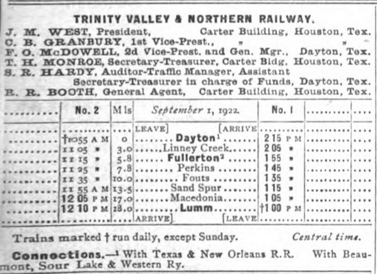
Right:
The 1923 edition of the Official Guide of
Railways and Steam Navigation included this timetable for
TV&N passenger operations effective September 1, 1922. The mill at Ladd
no longer shows a station, although it is likely that the train
overnighted at Ladd. Service commenced at Dayton at 10:55 am and went as
far north as Lumm -- the end of the line for the TV&N. The entire
round-trip was only once daily, finishing back at Dayton at 2:15 pm.
New stops along the line compared to the 1910 schedule were at Sand
Spur, Macedonia and Lumm, all north of Fouts, and at Perkins and Linney
Creek south of Fouts. The T&NO and BSL&W connections remained listed,
with the connection at Dayton implying that TV&N had some way of
negotiating the crossing at Tower 110 to reach the T&NO depot. This
was prior to the demise of Tower 110 and likely involved one or more
reverse moves. There was a wye near Ladd that may have been used. How the TV&N managed to reach the T&NO depot across Tower 110 for passenger service
is undetermined, but the removal of Tower 110 in 1927 certainly ended
it. |
 |
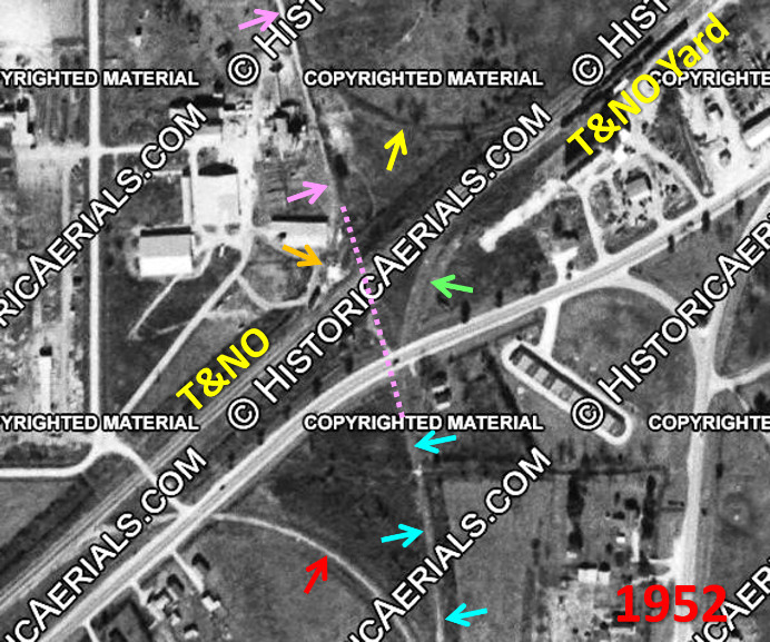
Above Left: A
short section of the former TV&N tracks (pink arrows) may have existed at
the Tower 110 crossing site when this
image from 1952 ((c) historicaerials.com) was captured. If so, then it was
accessed from the T&NO by a northwest quadrant connector (orange arrow.) The
opposite connector (yellow arrow) appears abandoned. The TV&N had crossed over (pink dashes) the T&NO to connect to
the D&GC main line (blue arrows) on the south side. The D&GC east connector (green arrow) led to T&NO's yard and passenger depot. Among all four
quadrants, the southwest connector (red arrow) is the only one that remains in place,
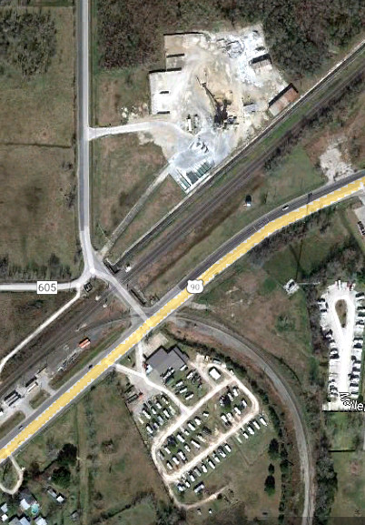
as shown (above right) by this January, 2022 Google Earth image.
Below: A grade-separation project
plan is being developed to eliminate the Waco St. grade crossing of the main line and the US 90 grade crossing of
the southwest connector. (Google Street View, May 2023)
In
January, 1920, Dayton Mills was sold to the South Texas Hardwood (STH) Co., a
company based in Houston with its production done at a contract mill in
Cleveland. STH had acquired rights to approximately 70 million feet of timber in north Liberty County
five miles north of Lumm, a location the company called
Havens (undoubtedly named for STH's principal owner, A. C.
Havens.) The TV&N ended at Lumm and thus did not actually extend as far north
as Havens. Yet, there is a right-of-way clearly visible on satellite imagery extending north from Lumm, crossing over TX 105 (images farther above)
into what should be the vicinity of Havens.
 |
 |
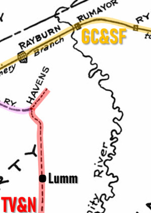
Far Left:
This annotated snippet from a map sketched by the Gulf, Colorado & Santa
Fe (GC&SF) Railway shows the area identified as Havens. The dashed
line (red highlight) running through Lumm to
Havens is indicative of the TV&N because south of Lumm (on the larger map),
it goes to Fullerton and
Dayton.
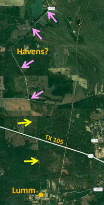
Near Left:
There is a right-of-way visible on Google Earth satellite imagery that
runs generally north from Lumm (yellow arrows.) North of State Highway
105, the right-of-way eventually becomes County Road 2185 (pink arrows.)
The shape of the right-of-way where it is occupied by County Road 2185
-- a slight west curve followed by a larger east curve followed by a straight section on a
45-degree heading -- generally matches the drawing of Havens' location
on the map. Nearly a decade before the sale to STH, at the January, 1911 tap line hearing before
the ICC examiners, Mr. Balderach had testified that the TV&N had completed a
preliminary survey of a route north from Lumm to Lamb (now Hightower), a
location on the GC&SF. He also stated that Dayton Lumber Company was
operating a tram north of Fouts.
Balderach later stated that the lumber company was not yet operating all
the way to Lamb. Havens was reported to be five miles north of Lumm,
which places it where the big curve is located on County Road 2185. It
was also described as 12 miles southeast of Cleveland, but it's closer to
11 miles due east. There is no obvious visual evidence that a right-of-way ever existed
beyond Havens to Lamb, at least not a direct one. |
As the timber between Dayton and Lumm played out by
the late 1920s, it is likely that the only raw logs being shipped to Ladd were from
STH's harvesting at Havens. Logs would have been carried by tram
rails to Lumm and over the TV&N tracks to Ladd. STH and the TV&N
must have determined that
hauling logs from Havens to Ladd would be less expensive overall if the tracks
between Lumm and Fullerton were returned to tram status. This is inferred from
TV&N's decision to request permission from ICC to abandon the tracks north of
Fullerton. Apparently, no other traffic was being carried on this segment and thus, no
external revenue was being generated by TV&N. Most likely, the logging camp at Fouts was no longer in use;
STH had established camps much closer to Havens. Tram employees were
probably running the logging trains the
entire distance to Ladd, with TV&N simply collecting rights fees (which
effected no net gain to the enterprise as a whole.)
 |
Left:
The March 2, 1929 edition of
The Traffic World summarized the ICC
Finance Docket entry on the proposed abandonment of the TV&N between Fullerton and Lumm "due
to line having served purpose of transporting logs." Perhaps "having served"
should be interpreted as "only serving". |
On April 13, 1929, Tower 148, a cabin interlocker
with an 8-function mechanical plant, was commissioned by RCT to begin service at
Fullerton governing the TV&N's crossing of the BSL&W. A mere
three weeks later on May 4, 1929, the ICC
authorized the TV&N to abandon its tracks north of Fullerton. Why would TV&N
(or, for that matter, the ICC) allow a cabin interlocker to be planned for
Fullerton knowing that the abandonment of the tracks north of
there was in progress? The existence of Tower 148 lends credence to the idea that, despite the
abandonment, logging
trains would continue to operate across the BSL&W at Fullerton. The abandonment
between Fullerton and Lumm did not remove the rails; it merely changed how the
tracks were operated and managed, i.e. by a logging company tram line instead of
a common carrier. South of Fullerton, the TV&N continued to operate as a common
carrier, shipping lumber products from the mill at Ladd to its two trunk line
connections (and thus, as a tap line, continuing to receive revenue divisions
from each shipment.) RCT records list the BSL&W and the TV&N as the railroads
responsible for Tower 148, but that did not preclude logging trains from
operating through Fullerton with STH crews and equipment while paying trackage rights fees for the privilege.
 |
Left:
This image and caption appears in East
Texas Logging Railroads (Arcadia Publishing, 2016) written by
noted Texas rail historian (and well-known musician)
Murry Hammond.
The crossing at Fullerton
had never been interlocked, but it was almost certainly gated, with the gate
lined against the TV&N. TV&N trains had to stop at the diamond to open and close
the gate, but the TV&N operated very few trains overall, so its delays were
inconsequential. The BSL&W had more traffic through Fullerton, and its
trains had to slow to a restricted speed to observe the gate at
Fullerton to determine whether they had to stop. The Kenefick station was
only a little over a mile east of Fullerton, so BSL&W trains would be operating slowly
through Fullerton anyway, approaching or departing Kenefick. For the
BSL&W, the overall impact of the gated crossing at Fullerton had
apparently been insufficient to motivate installation of an interlocker
prior to 1929.
The BSL&W and its affiliated
GCL railroads became owned by
Missouri Pacific (MP) in 1925. For reasons undetermined, MP embarked on
a major push in 1929 to install cabin interlockers throughout the GCL network. In addition to Tower 148 at Fullerton, cabin
interlockers were installed at Edinburg and Edinburg Jct. (Towers
149 and 145), Edcouch (Tower
146), Lantana (Tower 147), Rosita (Tower 151),
Angleton (Tower 154), Grayburg (Tower 155), Allenhurst (Tower 156), Blessing (Tower 157)
and Placedo (Tower 158), all of them in 1929, all
of them cabin interlockers, and all of them at crossings of GCL tracks. There was no special reason to interlock Fullerton in 1929; it
was simply on MP's list. |
A cabin interlocker was an inexpensive way of
controlling a crossing without the need for a manned tower. For Tower 148,
logging trains would stop at Fullerton and a crewmember (or perhaps a STH
employee who had traveled to the crossing ahead of time) would enter the trackside cabin to set
the interlocker controls to signal any approaching BSL&W trains to stop before
reaching the diamond. This would also change the home signal for the logging
train to proceed across the diamond. If a BSL&W train was already too close to
the crossing, the interlocker would prevent changing the signals until after the
BSL&W train had passed. After the logging train had crossed the BSL&W, a
crewmember or employee would reset the controls to signal unrestricted movements
on the BSL&W tracks.
The January, 1929 edition of
Railway Signaling and Communications provided a
list of Automatic Block Signals Contemplated for 1929 in which there
are two entries involving the GCL at Fullerton: "Gulf Coast, Tex. to
Fullerton, 33 mi." and "Fullerton, Tex. to Beaumont, 50 mi."
If block signals were being contemplated by GCL for the entire distance
to Beaumont from
Gulf Coast Junction (where the BSL&W intersected the East Belt in Houston -- see
map at Tower 80), wouldn't one simple
entry in the list, e.g. "Gulf Coast, Tex to Beaumont, 83 mi.", suffice
to convey the block signaling being contemplated? The information was most
likely supplied by the railroad and Tower 148 was installed three months
later, so it's fair to assume that two separate entries of block signals
involving Fullerton was associated with the impending interlocker
installation. The specific implication for whether (and how) the interlocking plant
might
ultimately have been tied into the block signals is unclear. The eight
functions of the
Tower 148 interlocking plant are undetermined but four home signals and
four derails would be a good guess. Distant signals were not needed on
the TV&N -- trains always stopped at Fullerton. Distant signals were
probably not needed on the BSL&W -- trains were operating at restricted
speed into or out of Kenefick.
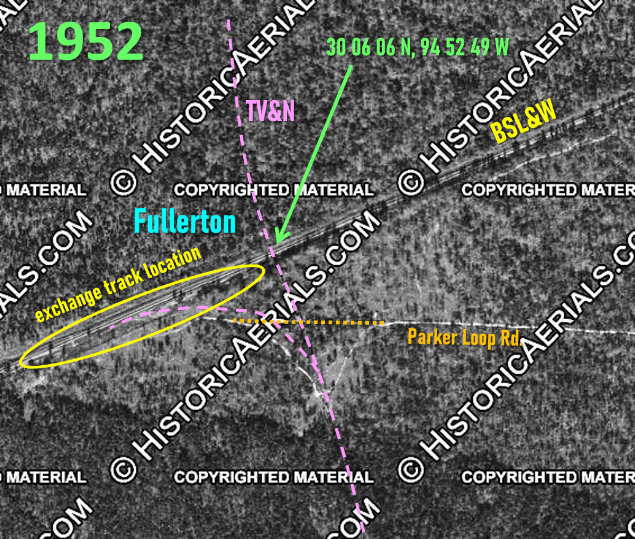
Right: This
annotated 1952 aerial image ((c) historicaerials.com) of the Tower 148 crossing
at Fullerton
shows that there was little left to see some twenty years after
the 1933 abandonment of the TV&N between Dayton and Fullerton. The
siding / exchange track appears to have been west of the diamond on the south side of
the tracks. The visible gravel road is now the far west end of Parker
Loop Rd. It previously curved abruptly south to cross the tracks at a
location where the road could match the elevation of the grade. It
then curved sharply back north to reach the siding and exchange track.
It now continues straight across the former right-of-way and terminates where the exchange tracks and sidings were located.
(A "Bird's Eye View" image of the exchange track area can be seen
here -- be patient; the map loads quickly but the image loads very slowly.) |
 |
Within a year after the installation of Tower 148
and the formal abandonment of TV&N's tracks north of Fullerton, STH decided that it needed to dismantle the mill at Ladd and relocate it to
Havens. While this would greatly reduce the time and expense of moving logs to
the mill, it would place the trunk line connections at Fullerton (17 miles) and
Dayton (23 miles) at lengthy distances from the mill. It would also require new
exchange tracks at Fullerton to be built on the north side of the crossing, or
perhaps restructured on the south side since heretofore, all TV&N trains with
products shipped out of the mill had approached Fullerton from the south. To obtain common
carrier divisions on outgoing shipments, the plan would
also require TV&N to reinstate ownership of the tracks between Lumm and
Fullerton, and add ownership of the tram tracks between Havens and Lumm (which
would probably need to be rebuilt to TV&N's specifications for common carrier
use.) Since extensive ICC approvals would be required for this approach, it was
apparently determined to be much less
expensive for STH simply to build a new 12-mile track from Havens to
Cleveland where two trunk line connections were available.
Above: On July 25, 1930, STH applied to the ICC for
permission to build a common carrier line between Cleveland and Havens under the
TV&N charter. Using the TV&N charter would eliminate the need for a
new charter from the Legislature, and it was viable to do so because TV&N's
charter had incorporated permission to build to Cleveland. Connecting at
Cleveland with two trunk lines -- the GC&SF and the Houston East & West Texas (HE&WT) -- would generate division revenue to TV&N for
products shipped from the mill at Havens, but only if the ICC approved
construction of the new line under common carrier "public convenience and
necessity" rules. If the ICC ruled that the new line had no public benefit, then
it could only be built as a private railroad and no division rates would be
available at Cleveland for interstate traffic (nor for intrastate traffic under
RCT's revised policy.) This map (courtesy Texas
Transportation Archive) was produced by the GC&SF in 1930. It was probably created as part of GC&SF's
submission of comments to the ICC in response to the "proposed branch"
On April 16, 1931, the ICC issued a
ruling that rejected STH's
application on the grounds that a rail line between Havens and Cleveland offered
no public benefit. As a result, the mill was not relocated from Ladd to Havens
and no tracks between Cleveland and Havens were ever built. The TV&N shut down
in 1932 and its remaining tracks, Dayton to Fullerton, were abandoned in 1933.
It is not known whether the abandonment of the remainder of the TV&N affected the need for Tower
148 since logging trains might still be crossing at Fullerton to reach the mill at
Ladd, as long as the mill remained open. The Texas Forestry Museum sawmill database indicates that the mill at Ladd
closed in 1934. At that point, if not earlier, Tower 148 could be closed, but
unfortunately, the actual date of its closure has not been determined. The BSL&W
and T&NO tracks remain in use today as main line routes through Fullerton and
Dayton, respectively, both now owned by Union Pacific. Fullerton is simply a
historical location; a town never developed. Dayton has become an exurb of
Houston with about 40,000 residents living within Dayton's Zip code.
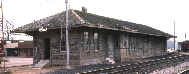
Right: SP depot at
Dayton in May, 1980 (C. E. Hunt photo)
The D&GC Valuation Report states that the railroad shared the T&NO's passenger and freight
stations at Dayton by paying 25% of the operating costs. The D&GC
undoubtedly did a brisk business moving Baytown residents and other
refinery visitors and employees to and from Dayton for access to SP's
passenger network. |
 |

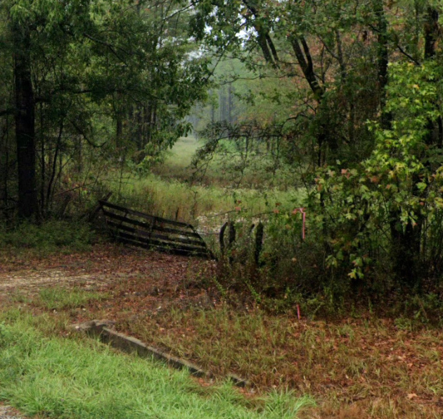
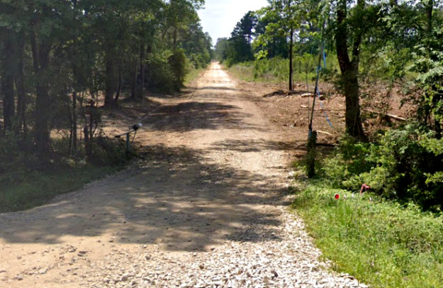
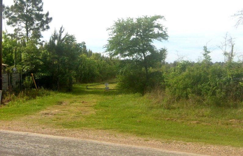
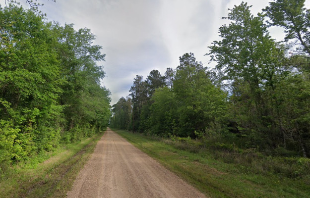
Traces of the TV&N from Google Street View: at Farm Rd. 1008 near Fouts
facing south (above left)
and north (above right); north
of Fouts at CR 2326 facing south (below left)
and north (below right)
Above Left: The pavement on
Waco St. in Dayton ends but the TV&N right-of-way continues north.
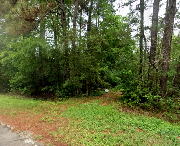
Above Right: A faintly visible
"Road Closed" sign marks the end of Tram Rd. where the TV&N right-of-way
continues into the woods on a northeast heading.
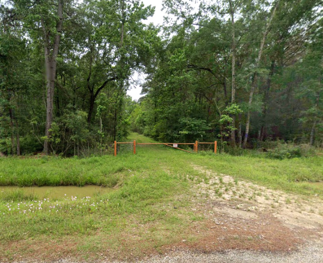
Below Left: Looking north, CR 6473 occupies the TV&N
right-of-way for three-quarters of a mile beginning just north of the Fullerton
crossing. Below Right: At the
north end, CR 6473 tees into Cumberland Rd., but the TV&N right-of-way continues
straight ahead. (Google Street View images)
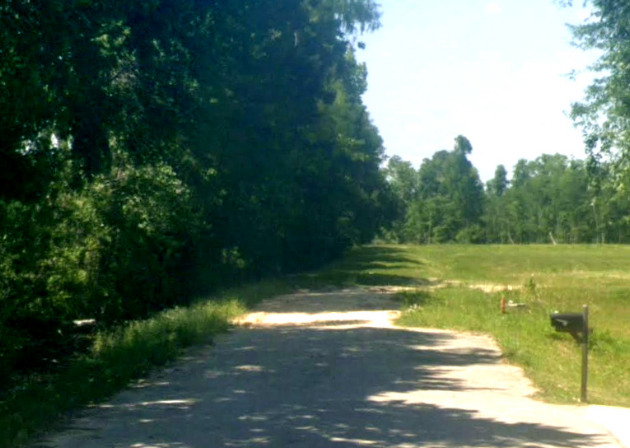
Above Left: North of TX 105, the right-of-way approaches from the south heading for
the area STH called Havens. It will become County Road 2185 (Palmer Lake Rd.) as it
reaches the camera, which is looking south from FM 2252. Above
Right: Palmer Lake Rd. continues north from its T-intersection
with FM 2252. The dirt road occupies the right-of-way through the "big
curve" (presumably the main site of Havens), but how much farther the tram
right-of-way extended is unknown. (Google Street View)
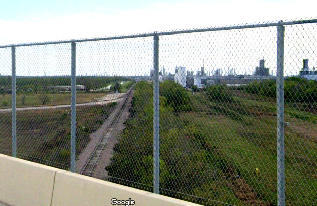
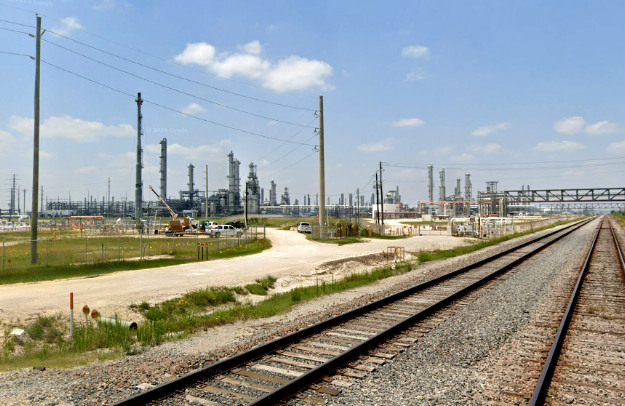
Below: In contrast to the
TV&N, these two Google Street Views of UP's former D&GC tracks fail to convey
the enormity of the petrochemical industrialization that has occurred between
Dayton and the refinery at Baytown. The refinery is so large that
there is no good way to show the railroad service into the plant.
Left: Looking south from the
Grand Parkway, the Baytown refinery is another 12 miles beyond the Exxon Mobil
chemical plant in the foreground. Right:
This view shows the Shell Oil facility north of the West Winfree Rd. grade crossing in Mont
Belvieu, a community between Dayton and Baytown. (Google Street View)