Texas Railroad History - Tower 32, Tower 74 and Mariposa Tower - Beaumont
Tower 32: A Crossing of the Texas & New Orleans Railroad and the Gulf,
Beaumont & Kansas City Railway
Tower 74: A Crossing of the Texas &
New Orleans Railroad and the Beaumont, Sour Lake and Western Railway
Mariposa Tower: A Santa Fe Tower to Manage Street
Crossings

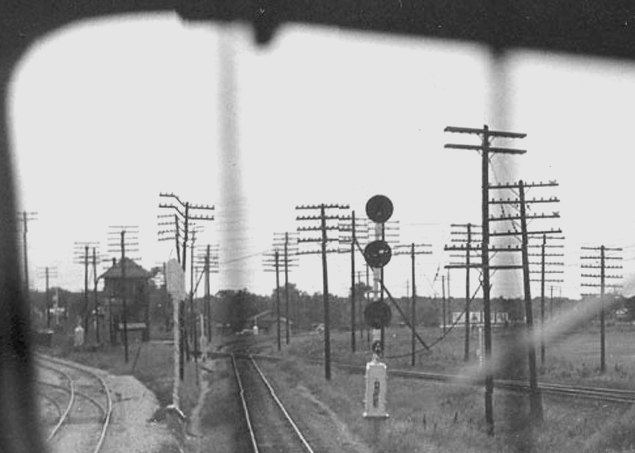
As railroad executive John W. Barriger III surveyed facilities in
the late 1930s and early 1940s for the federal Reconstruction Finance Corporation, he snapped
these two photos looking out the rear of his business car while traveling eastbound on the
Texas & New Orleans (T&NO) Railroad toward downtown Beaumont.
Above: Coming into Beaumont from Houston, the
first structure of interest that Barriger passed was Tower 74 where the T&NO
crossed over Missouri Pacific's (MP) main line between Beaumont and Houston. The
view is west-southwest along the T&NO right-of-way, with MP's tracks visible
crossing diagonally in front of the tower. Below:
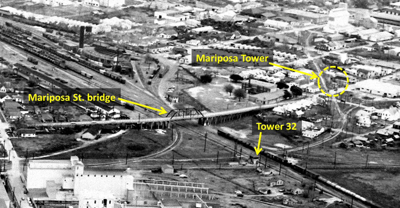
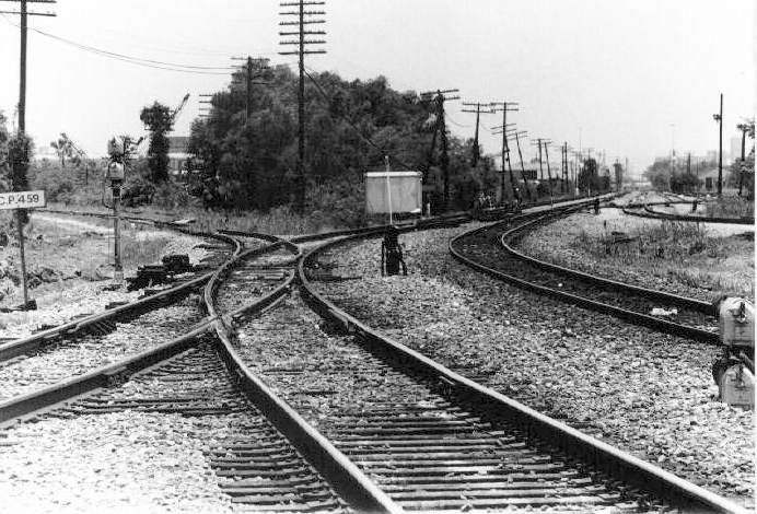
Less than a mile farther east, Barriger snapped the Mariposa Street bridge
with Tower 32 in the background. In this west-southwest view, the north/south Santa Fe line
crosses in front of the tower while the T&NO line to Dallas (north) and Port
Arthur (south) passes behind the tower.
(John W Barriger National Railroad Library)

"Texas & New Orleans Railroad" was the new
name adopted on Christmas Eve, 1859 by the Sabine & Galveston Bay Railroad and
Lumber Co. which had been chartered in 1856 to serve southeast Texas lumber
interests. By May, 1861, the "T&NO" had connected
Houston with Orange using wide (5' 6") gauge construction. In 1863, rails were
removed between Orange and Beaumont by Confederate forces to assist in building
a fort at Sabine Pass. The complete line between Houston and Beaumont was
rebuilt to standard gauge in 1866 and extended to Orange in 1876. Numerous disruptions caused by
war, sabotage, flooding, washouts,
bankruptcies and corporate restructurings had substantially delayed completion
of the original goal of reaching New Orleans, but a train finally made the trip all the way from Houston in 1880.
In the course of financial reorganization, the T&NO was sold to Southern Pacific
(SP) and soon thereafter, the T&NO's tracks through Beaumont became part of SP's
southern transcontinental Sunset Route. The T&NO later became SP's primary operating company in Texas and
Louisiana into which other SP railroads were folded in the 1927 - 1934
timeframe.
One of the railroads SP acquired well before then was the Sabine & East Texas (S&ET) Railroad.
The S&ET had laid
55 miles of rail in 1881 from Sabine Pass on the Gulf to the new town of Kountze. Crossing the T&NO's east/west main line,
the S&ET's north/south construction created Beaumont's first rail junction.
The S&ET was extended 48 miles farther north to Rockland in 1882 and was acquired by T&NO
in October. With additional construction and line acquisitions by SP, a complete
line from Beaumont to Dallas was established in
1903.
John H. Kirby
founded the next railroad into Beaumont.
Having made his fortune in timber land and sawmills, and needing better transportation
for his lumber products,
Kirby chartered the Gulf, Beaumont and Kansas City (GB&KC) Railway in 1893.
Within two years, a 52-mile line between Beaumont and Kirbyville was in
operation. In 1897, Kirby and other investors founded the Beaumont Wharf
and Terminal (BW&T) Company to lay rails connecting the industries along the Neches River
with the railroads in town. One of its lines branched off of the GB&KC on the
north side of town where the GB&KC entered Beaumont parallelling the T&NO's Rockland
line. The GB&KC was purchased in 1899 by the Atchison, Topeka & Santa Fe (AT&SF)
Railway, which was seeking access to a second Gulf port for its Gulf, Colorado &
Santa Fe (GC&SF) Railway subsidiary that served
Galveston with a main line to Temple
and points north. The GC&SF had a branch line east from Somerville (a few miles
north of Brenham) that had been built to pursue the growing
lumber commerce in east Texas. However, shipping from east Texas back to Galveston via Somerville
proved non-competitive with routes of other railroads via
Conroe and
Cleveland. Since the GC&SF tracks ended at Rayburn only fifty miles
west of existing GB&KC tracks at Silsbee, Santa Fe directed the GB&KC to begin
building yard and maintenance facilities at Silsbee while the GC&SF closed the
50-mile gap, completed in 1902. Santa Fe leased the GB&KC to the
GC&SF in 1903. The BW&T was also acquired by Santa Fe, but it remained separate until it was merged into the
GC&SF in 1957.
The next
railroad into Beaumont was the Gulf & Inter-State (G&I) Railway, chartered to
bring rail service to the town of Port
Bolivar on the Bolivar Peninsula across the bay from Galveston. The G&I proposed
to build a
rail line up the peninsula to the community of High Island and from there northwest
to Liberty where a T&NO connection would be made. The route to Liberty never materialized,
and instead, rail construction continued northeast at High Island, reaching Beaumont in 1896. The G&I tracks
entered Beaumont from the southwest, crossed T&NO's line to Sabine Pass and
connected with the GB&KC tracks at a triangle junction, the third leg being
Santa Fe's lead into downtown. In 1898, new G&I ownership hired Santa Fe to
develop the docks and tracks at Port Bolivar. Santa Fe bought the G&I in 1908 and integrated it
into the GC&SF.
 |
About the time the G&I's tracks first reached Beaumont,
Arthur Stilwell's idea to construct a route between Kansas City and a new port
on the Gulf of Mexico began to materialize. Under his Kansas City, Pittsburg
and Gulf (KCP&G) Railway, Stilwell acquired the Texarkana & Fort Smith (T&FS)
Railway to build and operate the Texas portion of his enterprise. In 1896, the T&FS built
24 miles south from Texarkana to the Louisiana state line,
crossing the Texas & Pacific along the way, and
also built 19 miles of track north from
Stilwell's eponymous new port, Port Arthur, into Beaumont. In between, the line
ran south to Shreveport, Louisiana and farther south to DeQuincy, where it turned southwest and
crossed back into Texas at the Sabine River. In 1897, the T&FS completed the remaining Texas
construction between the state line and Beaumont, bridging the Neches River near
downtown and connecting with the tracks from Port Arthur. Service
between Kansas City and Port Arthur commenced on November 1, 1897 and
remains in operation today.
In
1899, Stilwell lost financial control of the KCP&G and it was acquired in
1900 by the newly chartered Kansas City Southern (KCS) Railway. Because KCS was
not headquartered in Texas (it was chartered in Missouri), Texas law
required it to lease, rather than own, the T&FS. In 1933, the State of Texas appealed
an Interstate Commerce Commission ruling that granted KCS permission to acquire the T&FS, notwithstanding Texas law to the contrary. The
Supreme Court
upheld the ruling in 1934. Formally merging the T&FS was delayed until the
existing lease expired in 1943. Stilwell's founding of Port Arthur was
also a boon to the T&NO. Its tracks from Sabine Pass to Beaumont ran
along the west side of Port
Arthur, an area that quickly became the site of numerous industrial facilities. The T&NO abandoned the
tracks south of Port Arthur to Sabine Pass in 1932, but the Beaumont -
Port Arthur line remains in operation by Union Pacific, the T&NO's
successor. |
On January 28, 1904, Tower 32 was authorized for operation by the Railroad Commission of
Texas (RCT), officially recorded as a GB&KC/T&NO crossing. The electrical interlocking plant controlled 37 functions,
exceeded at the time only by a 45-function interlocker at
Tower 21 and a 54-function interlocker at
Tower 26. The tower had tracks on three sides: the T&NO's
Sunset Route on the south side, the GB&KC tracks on the east side (leased to
the GC&SF), and the T&NO's Sabine Pass / Rockland line on the west side.
The last railroad into Beaumont was the Beaumont, Sour Lake and Western
(BSL&W) Railway. It was chartered in 1903 to build west from Beaumont to the
newly developed oil field at Sour Lake. In 1905, it was sold to B. F. Yoakum,
who added it to his collection of railroads known as the Gulf Coast Lines (GCL).
To reach the Port of Beaumont, the BSL&W tracks crossed the T&NO main line about
a mile west of Tower 32, a crossing that became interlocked with a 12-function
mechanical plant commissioned as Tower 74 on May 15, 1908. As the BSL&W built
west from Grayburg, near Sour Lake, to Houston in
1908, Yoakum negotiated trackage rights on the KCS from Beaumont to DeQuincy,
where another GCL railroad had tracks that ran to New Orleans. The BSL&W connection
with the KCS in Beaumont became known as "GCL Junction", a term that remains in
use today. In 1925, the GCL collection of railroads was acquired by Missouri
Pacific (MP).
Below: This annotated Sanborn Fire Insurance Index
Map of Beaumont from 1911 shows the major rail routes. In addition to Towers 32
and 74,
there was one other tower operating in the Beaumont area in 1911.
Tower 31 was located at the KCS / T&NO crossing off the map to the right.
There was never an RCT-numbered interlocker at GCL Junction.
The crossings of three rail lines a short distance south of Tower 32 might have
been controlled by the Tower 32 interlocker, but this has not been determined.

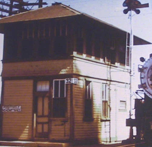

Above Left: Tower 32 appears in this cropped
image of a photo taken by R. D. Evans, March 8, 1956. (Texas & New Orleans Color Pictorial by Steve Allen Goen,
Four Ways West Publications, 2004; used with permission.)
Above Right: Eastbound SP train #2 passes along
the south side of Tower 32 in early 1950 and has already crossed the T&NO line
that ran immediately beside (and west of) the tower. The locomotive is about to
cross the Santa Fe track that was a few yards east of the tower. (Raymond
Mueller photo)
Below: This
annotated image derives from a 1954
aerial photo of Beaumont (Don Johnson collection, hat tip, Mark St. Aubin) that
is facing generally east-southeast. The T&NO Sunset Route and yards are on an
east-northeast heading into downtown to the left. Tower 32 is visible west of
the Mariposa St. bridge. The T&NO Dallas/Port Arthur line is visible passing
this side (west) of the tower while the Santa Fe tracks pass on the opposite
side of the tower, curve to the southeast toward downtown, and split. The left
branch continues toward the Santa Fe depot downtown while the right branch
curves back to the southwest and proceeds to High Island on the former G&I
route. Mariposa Tower was located in the yellow circle, just past
Santa Fe's Orange Ave (Mariposa St.) grade crossing, but is hard to detect
because it consisted of a small cabin on an open 3-story structure. Mariposa
Tower is referenced in a Santa Fe letter to RCT in 1961 regarding its closure.
It was a watchman's tower with an operator responsible for controlling signals at street grade crossings to help expedite the movement of trains in the
vicinity (see discussion and photo further below.)
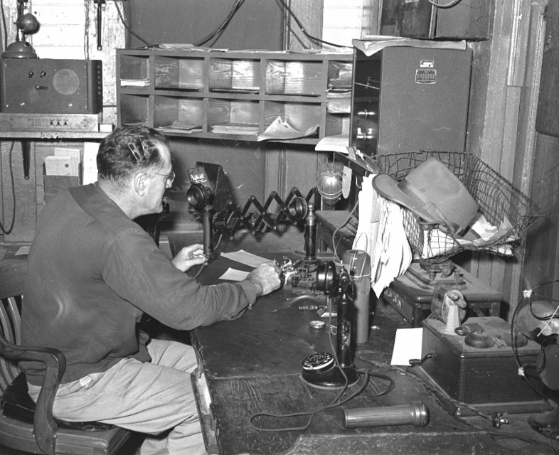
Above: 1953 photos of Tower 74
taken by Steve Bartlett. Steve adds: "I can't
tell from the photo but I think the operator was Mr. Cormier.
Another would have been Mr. Dennis...inside the tower
at his desk.
I never learned their first
names. As I recall, Cormier was first
trick, Dennis second trick. There was a third regular operator, plus varying
reliefs on weekends.
The MP dispatched trains over the company
telephone but the telegraph still worked and and was occasionally used.
The telegraph and telephone call for Tower 74 was 'WY'. I regret that
I never took pictures of the interlocking levers. They controlled the moving
point crossing, the switch to WY siding which began just west of the tower and
paralleled the main track to just west of 23d St."
Additional Photos and
Captions from Steve Bartlett
"The Old Main
(my name for it) swung sharply north just about at the WY siding switch and
paralleled 11th St north, turning west again just south of Calder Ave. It
rejoined the west end of WY siding just west of 23rd St. I think it may have had a
spring switch at that end. I remember it had a spring frog. The tower was pipe-connected to the crossing, the WY siding switch, the Old Main Switch, and the SP
Long lead switch, plus facing point locks on each. The original signals were
pipe-connected semaphores but had been converted to lighted, electrical
signals."

Above Left:
"No.
3, The Orleanean, day train between New Orleans and
Houston, picking up clearance and orders, if any.
Note beyond the train, on the SP, two tracks. The left is the main track and to
the right is the Long Lead, frequently used by freights entering and leaving the
SP yard farther east. The Long Lead switch was controlled by Tower 74."
Above Right:
"A view from the cab of a westward
freight, doing setouts and pickups in the yard, just east of Tower 74. The track
to the far right is the interchange track used by MP and SP. The second signal
arm is cleared, showing the route was lined for WY Siding. The lower signal arm
cleared to Lunar White for the Old Main Track."
Below Left:
"No. 3 on the main, WY Siding beside it, and the Old Main on the left of the
water tower. This track was used once in a while, at least once a year, to keep
it legally in service. I saw one of the freights on it one afternoon. The west
end switch for WY siding was controlled from the small GRS control box over the
operator's desk." Below Right:
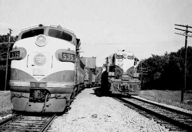
"The train on the left is a freight with two F3 units, the usual freight power,
on the siding, waiting for the passage of No. 3, on the main track, with a
GP7. Freights occasionally had two Alco FA units and No. 3 and No. 4 usually had
an F7, occasionally a GP7, and once in a while, an Alco PA."
In the early 1960s, a major cooperative effort among Beaumont's railroads led to
many changes in rail traffic flow. SP and Santa Fe
built a connection between their parallel tracks at the Broadway St. grade
crossing about one-third of a mile north of Tower 32. This moved northbound SP
trains onto Santa Fe's tracks at Broadway St. From there, SP trains continued north
past Santa Fe's freight yard all the way to Loeb Jct. (near Lumberton) where
they returned to SP rails.
This allowed SP to abandon 9.5 miles of track
between Broadway St. and Loeb in 1961. Santa Fe's line that passed Mariposa
Tower from downtown was re-directed to connect to SP's tracks on the north side
of Tower 32. This allowed Santa Fe to abandon its tracks south of Broadway St.
and begin using SP rails to Tower 32 to reach the downtown connector. As Santa Fe
dismantled their downtown operations (and requested RCT permission to
close Mariposa Tower in 1961 as discussed further below), a new connection to reach Santa Fe's line to High Island
was needed. This was accomplished with a branch off of SP's Port Arthur line
which Santa Fe reached using SP's tracks south of Tower 32. Burlington Northern
Santa Fe (BNSF) is the successor to Santa Fe and continues to operate the former
Santa Fe lines in Beaumont.
A much bigger change affecting Beaumont rail traffic occurred in the latter
half of the 1960s motivated by several factors. On the railroad side, SP desired to expand its yard which was not feasible at its downtown
location. On the civic side, city officials and the Port of Beaumont had issues
with SP's route through town. Steve Goen explains:
Beaumont was not
happy with the fact that the SP main line sliced right through downtown and
incredibly close to several multi-story buildings. Whenever an SP train passed
through downtown, it literally brought everything to a standstill. Secondly the
Port of Beaumont likewise didn't like the location of SP's bridge across the
Neches as it was right next to their turning basin. The port was wanting to
expand capacity and simply could not do it with the SP's bridge being where it
was. So a plan was proposed in which SP would abandon its line through Mariposa
Yard and would pass through town via the KCS (MP) route several blocks to the
south. This allowed SP to abandon all trackage downtown, past the SP station,
and through Mariposa Yard. At almost the same time, KCS discontinued the FLYING
CROW which in turn allowed them to abandon the old KCS-GCL station. This left SP
free to construct a new station well west of downtown. This is the station that
Amtrak originally used and where a new replacement station is today.
With all three lines (SP-KCS-MP) routed through downtown on the KCS route, that
cleared out SP through the main downtown business district. The new yard was
constructed, the SP station razed, and SP's bridge removed. It was a drastic
overhaul of the railroad scene in Beaumont
SP built a new yard west of Tower 74 and eliminated its yard and
tracks in downtown (except for an industry spur remaining in place east from
Tower 32.) Removing its downtown tracks required SP to begin using MP's route
east from Tower 74 to GCL Junction. At GCL Jct., SP trains moved onto KCS rails,
crossed the KCS bridge over the Neches River, and continued a mile farther east to
Tower 31 where they rejoined the Sunset Route. With this operation in
place, SP abandoned its main line between Tower 32 and Tower 31 in 1967. SP's
Neches River bridge was dismantled two years later. SP also revised their Port
Arthur line; instead of continuing north to Tower 32, it was curved west onto
the MP tracks toward Tower 74 to reach SP's new yard. With SP no longer
accessing Port Arthur via Tower 32, the rails south of Tower 32 were curved
directly onto Santa Fe's High Island line. All of these changes meant that Tower
32's complex interlocking plant was no longer needed. Most of the traffic it saw
was infrequent north/south Santa Fe movements accessing the High Island line.
The interlocker was removed and replaced with a gate to guard access to SP's
industry spur toward downtown. When this spur was rerouted to become a
connection south of the diamond, the diamond was removed. The date and fate of
the ultimate demise of the Tower 32 structure is undetermined.
For its part, MP obtained trackage rights from SP
west from Tower 74 to Langham Road, where it built a new 1-mile connecting track that
angled northwest to rejoin the MP main line. This allowed MP to abandon 3.6
miles of track west of Tower 74 in 1962; a short section of track was retained
near the tower as
an industry spur. By the late 1960s, the Sunset Route through Beaumont had become a
four mile double-tracked main line corridor used by both MP and SP from the MP connector
near Langham Road all the way to GCL
Junction. Union Pacific (UP) became the successor to both MP and SP, and
continues to operate substantial traffic through Beaumont. Although Tower 74 was
no longer a manually interlocked crossing, it was retained for traffic
management purposes. Bob Currie explains what happened to it...
"The
story I got from MP Tower 74 operator RD Strong is that the tower was destroyed
in a derailment. Strong was in the tower when it happened. The engineer on the
MP train that destroyed the tower was John Brown, who was the father of SP Tower
74 operator John �Bo� Brown. Bo told me the same story as RD Strong."
The
tower structure could not be repaired, so the railroads built a "new Tower 74"
-- just a small, single story pre-fab building -- to house the equipment and
tower operators, which also doubled as an Amtrak station. Bob continues...
"During the 20 years I operated through Beaumont, the
new Tower 74 had 2 operators on duty, 24/7. One operator controlled the CTC
board, and the other operator copied both SP and MP train orders. The CTC
operator�s job was split between SP and MP operators, while the train order
operator was always an SP employee. Bo Brown, an SP operator, usually worked the
third shift CTC job."

Above: Annotated map
of Beaumont showing numbered towers and other locations. (G = GCL Junction, M =
Mariposa Tower, K = KCS Tower at the Neches River Bridge)
Below: GCL Junction is largely
unchanged since the days of B F Yoakum. The double track along the upper side of
the triangle is the Sunset Route, which narrows to single track at KCS Tower
(off image to the right) to cross the Neches River. The south leg is KCS' route
to Port Arthur, but it also provides access to extensive industrial activity
along the banks of the river. KCS continues today to operate its route through
Beaumont, which has changed little since 1900.

Below: Two photos provided by Ted Ferkenhoff, who supplies these captions:
Below Left:
This view is looking east, with the Amtrak station/Tower 74 (new version) to our
back. The alignment veering to the right is that of the MoPac toward GCL Jct. The track diverging to the lower left is a remnant of the
old MoPac main used to serve a gravel company. The track diverging
to the upper left is remains of the former SP
main, referred
to as the "NO Main" (i.e. "T&NO" Main.) The yard
in the distance on the right is the MoPac
downtown yard, and the
track running on the far right is known as the "Roy Jones"
connection, and connects
to SP's yard which lies west (behind
the photographer). The site of the original Tower 74 building
is to the right
just out of the photo.
Below Right:
This was the "new" Tower 74, which shared a building with
the Amtrak waiting
room at Beaumont until
it closed in April 2000. It was replaced by dispatcher control
at Spring, TX. The
windows to the far left are the waiting room,
and the windows to the right are the operator's office where the CTC board
was located.
The remainder of the building to the right of the
windows was
a room full of relays and other electrical gear.

Below:
interior photo of the "new" Tower 74 c.1998 (Mark St. Aubin photo)
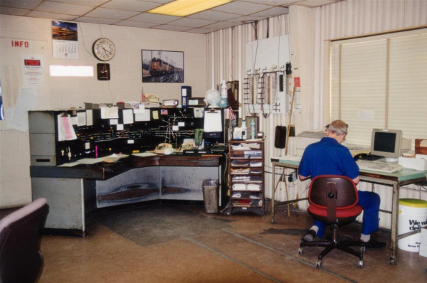 Update from Howard Bingham
(Oct. 5, 2006): "The 'new' Tower 74 building...no longer exists. The building was leveled by the UP about 2 1/2 years ago after the City of Beaumont condemned the
building due to damage caused by vagrants. All that remains today is a concrete
pad where the building once stood in addition to the boarding platform which
continues to serve any Amtrak passengers boarding at Beaumont."
Update from Howard Bingham
(Oct. 5, 2006): "The 'new' Tower 74 building...no longer exists. The building was leveled by the UP about 2 1/2 years ago after the City of Beaumont condemned the
building due to damage caused by vagrants. All that remains today is a concrete
pad where the building once stood in addition to the boarding platform which
continues to serve any Amtrak passengers boarding at Beaumont."
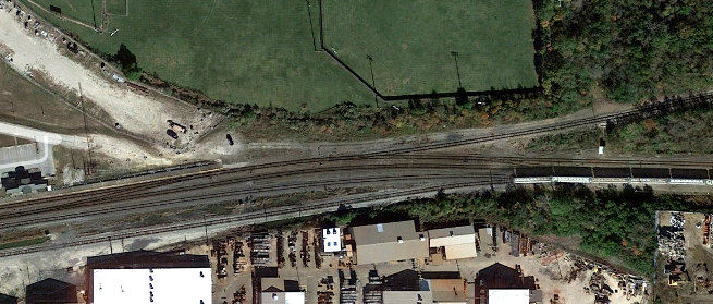
Below:
November, 2022 satellite view of the former Tower 74 crossing (Google Earth)
 Left:
This Google simulated 3D view combining satellite imagery with ground elevation
data shows that a new Amtrak shelter has been built to replace the "boarding
platform" referenced above. The building at the bottom is a Police Substation.
The view is east along UP's double-tracked main line toward GCL Jct. The former
site of Tower 74 is in the trees across the tracks to the right. The spur that
branches to the left is the former SP main line to Tower 32 and downtown, and is
where Barriger's car was traveling as he snapped the photo of Tower 74 (top of this
page) looking out the rear of his eastbound business car. In those days, SP's
main line right-of-way had three tracks while only a single MP track crossed at
the tower toward GCL Jct.
Left:
This Google simulated 3D view combining satellite imagery with ground elevation
data shows that a new Amtrak shelter has been built to replace the "boarding
platform" referenced above. The building at the bottom is a Police Substation.
The view is east along UP's double-tracked main line toward GCL Jct. The former
site of Tower 74 is in the trees across the tracks to the right. The spur that
branches to the left is the former SP main line to Tower 32 and downtown, and is
where Barriger's car was traveling as he snapped the photo of Tower 74 (top of this
page) looking out the rear of his eastbound business car. In those days, SP's
main line right-of-way had three tracks while only a single MP track crossed at
the tower toward GCL Jct.
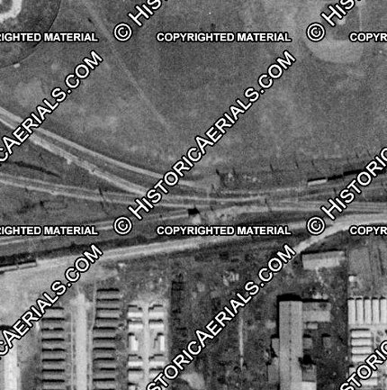
Below:
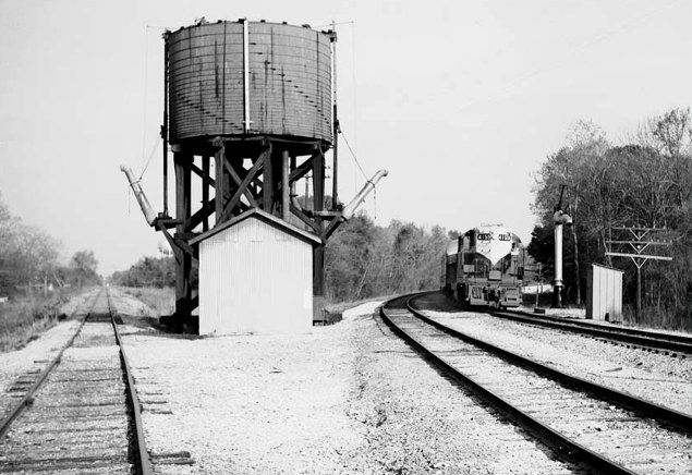
Tower 74, c.1957 ((c)historicaerials.com)
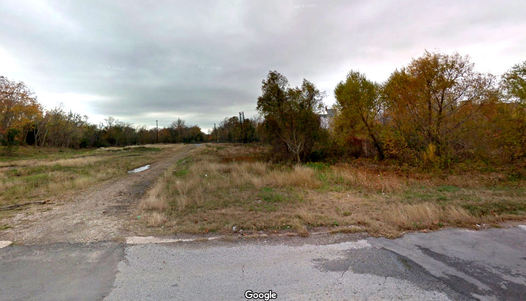
Above: This 2011 Google Street
View image is
essentially the same view as Barriger's shot of the Mariposa St. bridge at the
top of the page.
When the T&NO's downtown tracks and yards were removed, the Mariposa Street bridge was dismantled and replaced by a surface roadway,
from which this image was captured. Patches are
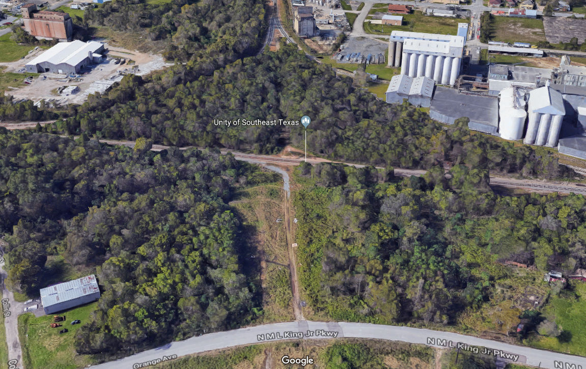
visible where industry spurs were removed. Below: An elevated 3D view from approximately the same location
and direction as Barriger's photo of Tower 32 shows tracks remain in place west
of the crossing, retaining north and south connections to the crossing track on
the original T&NO alignment.
The angled "gap" in the trees just below the middle left edge of the
image is the Santa Fe right-of-way which curved toward downtown (lower left
direction) after crossing the T&NO. Note that Mariposa Street, which
replaced the bridge visible in Barriger's photo, has been renamed North M L King Jr.
Parkway. An actual parkway by that name carrying substantial traffic is behind
the camera, but this original surface street remains intact and becomes Orange
Ave. as Mariposa St. once did. (Google Street View)
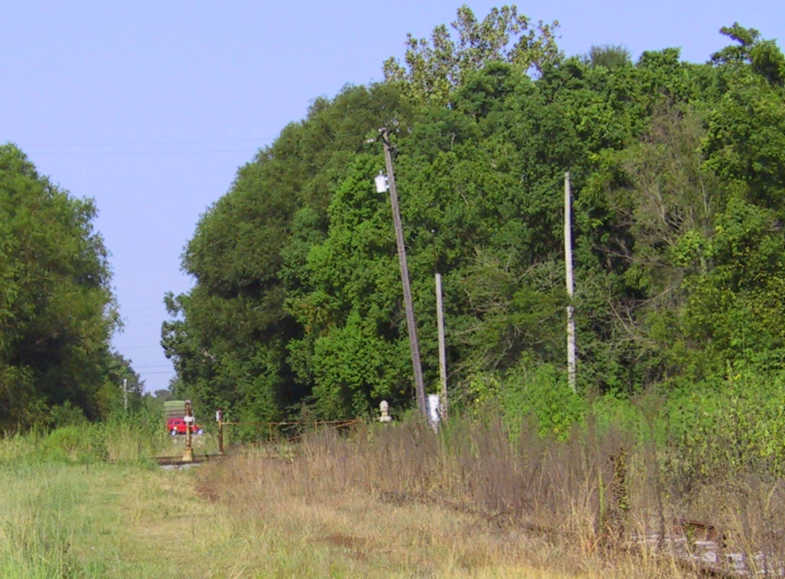
Above Left: This 2004 photo taken by Jim
King faces west at
the Tower 32 crossing. Although a gate is visible, Gary Williams
reports that the Tower 32 diamond "was removed December 14, 1998." Satellite
imagery from November, 2022 might show a hint
of a shadow cast by the gate, apparently still intact and
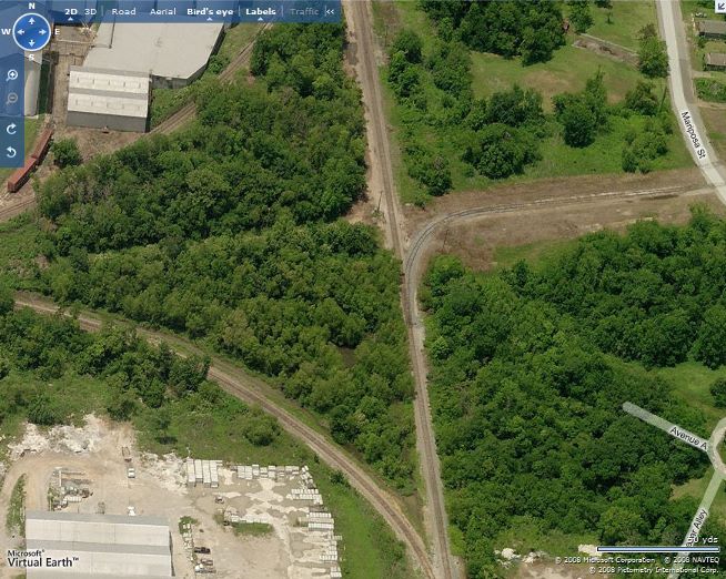
guarding nothing. Rails are no longer buried in the weeds; by 2008, (image
above right facing north) the entire area
had been
cleared. The spur track across Mariposa St. survived the original abandonment
east of Tower 32 and was served from the west across the diamond until the lead
was added from the northbound track. (Microsoft Virtual Earth image)
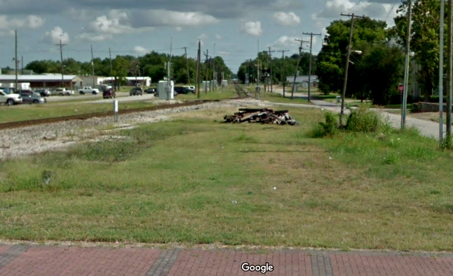
Below: This May, 2018 Google Street View
looks south from Calder Ave. down the original SP alignment towards the site of
Tower 32. The track angling in from the
left brings southbound trains off the original Santa Fe alignment onto the
former SP tracks at Broadway St., the next grade crossing south of Calder. The
abandoned Santa Fe right-of-way runs south through the gravel parking area
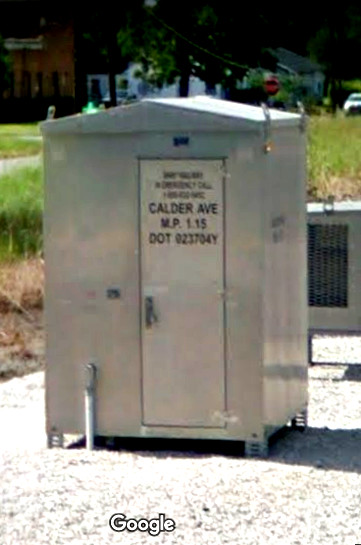
behind the equipment cabinet at left of center, which is marked "U.P.R.R." A similar one at the
Calder Ave. grade crossing (behind the camera) is marked "BNSF
Railway", reflecting the track ownership transition that still persists from
1961.
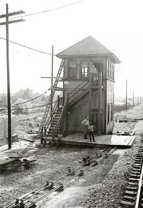
Mariposa Tower
Mariposa Tower was a watchman's tower two tenths of a mile from Tower 32 that
was used by Santa
Fe to control street grade crossing signals. Watchman's towers were common
in urban areas and were never numbered or managed by RCT since they had no
interlocking plants or similar controls. In this case, however, RCT
did have a file folder for Mariposa in its records archived at DeGolyer
Library. Mariposa Tower was located at the intersection of
Orange St. (S. Mariposa Ave.) and Cement (also known as Ellison Court, but no
longer existing) within the triangular junction of three Santa Fe lines. The
northwest line was the GB&KC tracks to Silsbee. The southwest line was the G&I
tracks to Port Bolivar via High Island. The third line went generally east toward
downtown and terminated at the Santa Fe depot. RCT's Mariposa file contains only one
item, a letter written by Santa Fe to RCT on February 2, 1961 discussing plans
to close the tower and requesting RCT approval to do so, even though they
recognized that approval might not have been required. The fact that Santa Fe bothered to
write RCT regarding this tower suggests that it had played an important role in
managing train movements. The letter explained that the grade
crossing signals operated by the towerman were being converted to automatic
operation, and that discontinuance of passenger and freight service to Santa
Fe's downtown depot would eliminate most of the train movements through this
area, leaving "only one freight train in and out every other day between Silsbee
and High Island."
 |
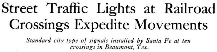
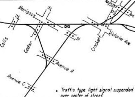
Left and Below:
An article about Mariposa Tower in the April 21, 1928 issue of
Railway Age explains that Santa Fe
worked with Beaumont city officials to install typical traffic light
signals at ten street grade crossings that carried "80 to 100 train
movements" daily. The city had previously ordered "all trains to stop
for each street and a brakeman to proceed ahead to flag the crossing."
The result was that "trains moved so slowly through this area that the
street traffic was delayed unnecessarily." Santa Fe designed a
system to allow the tower operator to control each traffic signal
separately. Some crossings were not visible from the tower so "an
illuminated track diagram...was placed over the switches in the tower,
the lights in the diagram being controlled by track circuits so that the
towerman knows the location of each train." Installed in July, 1927, the
system allowed train speeds to increase "...to about 15 m.p.h. over these
crossings, which...reduces the delay to street traffic."
 |
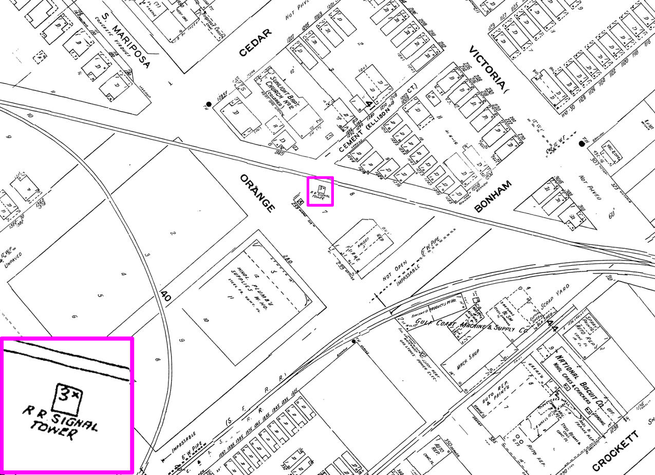
Above: Mariposa Tower is the small square
building highlighted in the center of this image taken from the 1941 update to
the 1929 Sanborn Fire Insurance map of Beaumont (rotated so that due north is
up). The tower is just below the Santa Fe main line that slants across the
image, within a large triangle of Santa Fe tracks. One triangle lead is the
GB&KC at upper left; off the map, this line curves due north past Tower 32. The
triangle lead at the right edge goes into downtown Beaumont to reach the Santa
Fe depot. The third lead is at the bottom of the image where the two tracks
merge (off the map) to proceed southeast on the G&I tracks to High Island.
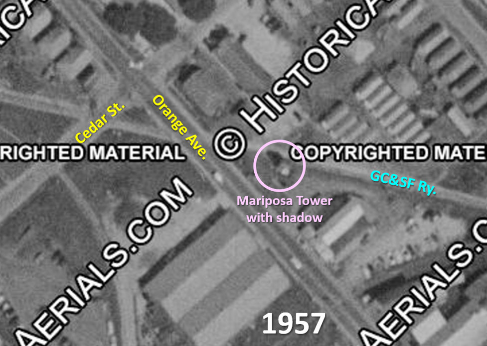
Above: In this annotated 1957
aerial image ((c)historicaerials.com), note that the two conjoined buildings
along Orange St. south of the tower are also visible in the image below.
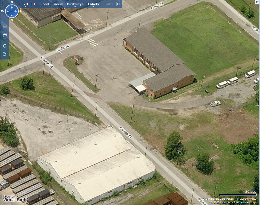
Below: Mariposa Tower was
located where a line parallel to and extending from the northwest wall of the two buildings
on Orange St. intersects the former Santa Fe right-of-way
near the center of this image, perhaps the visible "gray spot". The angled dark patch in Orange St. is the Santa
Fe right-of-way. (Microsoft Virtual Earth)