Texas Railroad History - Tower 72 and Tower 184 - Corsicana
Crossings of the St. Louis - Southwestern Railway with the Trinity &
Brazos Valley and Texas & New Orleans railroads

Above: Looking west on the Cotton Belt, this image of Tower 72 was
captured by John W Barriger III in a photo taken in May, 1931 as he was eastbound on a
Cotton Belt train toward Tyler. The Burlington -
Rock Island tracks, originally the Trinity & Brazos Valley, cross in the
foreground with north to the right. In those days,
Tower 72 was a substantially different structure compared to images taken
decades later. This is not
without precedent -- like other structures, towers were damaged by
fire,
tornadoes, railroad accidents, etc., plus modifications made for new equipment
or operational requirements. Files at DeGolyer Library show that the
tower was modified multiple times, but more research is needed
to determine if (or more likely, when) a complete rebuild was accomplished.
Below: Barriger took this photo at the Tower 184
crossing, also eastbound on the Cotton Belt, very shortly before passing
Tower 72 above (presumably, but unconfirmed, on the same trip.) The Southern Pacific
tracks cross north to south (right to left) in the foreground. As in the photo
above, the view shows the Cotton Belt disappearing
into the west
horizon toward Waco which was likely Barriger's most recent stop. The trackside water tower is
also visible in both images. (both photos, John W. Barriger III National
Railroad Library)

The Houston & Texas Central (H&TC) Railway began
building north from Houston prior to the Civil War, but it was not until a few
years after the war that construction resumed. Railroad Commission of Texas
(RCT) records show the H&TC tracks finally reaching Corsicana, from Groesbeck
(38.6 miles), in 1871. The following year, construction continued
all the way to Dallas, an additional 58.6 miles. The H&TC became a property of
the Southern Pacific (SP) system in 1883, but it continued to operate
under its own name.
About the time the H&TC
reached Corsicana, the Tyler Tap Railroad was being chartered in Tyler. It's
goal was simple: "tap" the nearest rail line to bring service to
Tyler, an
important east Texas town 70 miles northeast of Corsicana. But the nearest rail
line was much closer than 70 miles; a 21-mile narrow gauge line was
built from Tyler to Big Sandy to connect with the
Texas & Pacific, completed in 1877. In 1879, new investors amended the Tyler Tap's charter
with bigger plans: convert to standard gauge and build northeast from Big Sandy to
Texarkana, and southwest
from Tyler to Waco. They also changed the name to the Texas & St. Louis (T&SL)
Railway. The T&SL tracks reached Corsicana (via
Athens) in 1881 and crossed the H&TC near the
center of town, continuing to Waco that same year. After two foreclosures, the
T&SL line became the property of the newly chartered St. Louis Southwestern
Railroad (traditionally abbreviated "SSW", but more commonly referenced as the
"Cotton Belt") in 1891. With all four directions covered by SP or Cotton
Belt service, Corsicana prospered, reaching a population of 5,000 by 1885.
In 1907, another railroad passed through Corsicana as it built north toward
Dallas. This was the Trinity & Brazos Valley (T&BV) Railway, which by its
original 1902 charter would not have come any closer than 25 miles from
Corsicana. The T&BV's plan was to build southeast from
Hillsboro toward
Beaumont, but its location and charter became a tempting combination for
railroad magnate B. F. Yoakum. While Yoakum had substantial experience in Texas
railroading, he'd advanced well beyond Texas, reaching the top rung of US
railroading. His rail empire in the early 1900s included being Chairman of the Chicago, Rock
Island and Pacific ("Rock Island") railroad, Chairman of the St. Louis San
Francisco ("Frisco") railroad, a Director of the Colorado & Southern (C&S)
railroad, and owner of a controlling interest in various railroad properties in
south Texas collectively known as the Gulf Coast Lines (GCL). Yoakum's Frisco
and Rock Island railroads operated in north Texas, but lacked a connecting line
to his GCL roads in south Texas. Significant north/south traffic originated by
Yoakum's companies in both directions was being lost to SP's route
between Houston and Dallas, the one that passed through Corsicana.
Yoakum
was interested in the T&BV. Their construction from Hillsboro to the southeast had stopped at the town of
Mexia in
1904. Yoakum knew the area well; he was a native Texan born in 1859 in Tehuacana, a small community close
to Mexia, only a mile from the T&BV's new tracks. Yoakum wanted to acquire
the T&BV and convert it to a north/south railroad serving Houston and Dallas,
serving as a connecting railroad for his existing lines in north and south
Texas. To
execute his plan, Yoakum arranged for the C&S to acquire the T&BV in 1905. He
then revised the T&BV's charter to build east from Mexia to the community of Brewer,
a distance of 14 miles. From there, he would build south to Houston and north to
Dallas on a fairly direct route, creating a lengthy but efficient north/south railroad.
The line would prosper carrying overhead traffic between his GCL (south Texas) and Frisco/Rock Island
(north Texas) railroads. Construction to Brewer (renamed and incorporated as the
city of Teague, his mother's maiden name) was accomplished in 1906, along with
substantial construction from Teague south toward Houston. In 1907, the
northward construction began, completing 67 miles from Teague through Corsicana
to Waxahachie. At Waxahachie,
Yoakum negotiated traffic rights into Dallas on the Missouri-Kansas-Texas
Railroad, and by the end of 1907, he had initiated Dallas - Houston service. While
many towns begged for one railroad, Corsicana now had three!

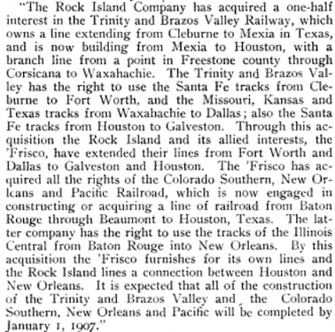
Above Left: Overview map of Corsicana railroads
Above Right: The April 20,
1906 issue of Railway World contained
this verbatim press release from Rock Island.
Unfortunately for Yoakum, his rail empire crashed, and
a lengthy receivership for the T&BV began in 1914. The tracks remained intact,
however, and continued to operate under the court's direction through the
appointed Receiver. The final bankruptcy plan issued in 1930 involved creation of the
Burlington-Rock Island (B-RI) Railroad, a joint venture of the Chicago, Burlington
& Quincy railroad and the Rock Island railroad, to acquire and operate the T&BV's
lines. The Burlington involvement stemmed from their ownership of the C&S. The B-RI
operated using assets of the two
parent railroads to conduct operations. The B-RI quickly abandoned the original
segment of the T&BV from Cleburne to Mexia, but Yoakum's new
construction from Mexia to Teague and points north and south remained intact.
The Mexia - Teague segment was abandoned in 1976, but the north/south line from
Houston to Waxahachie via Teague and Corsicana is now a major line of B-RI 's
eventual successor, Burlington Northern Santa Fe (BNSF.)
The T&BV's path
through Corsicana crossed both existing railroads, but only the Cotton Belt
crossing was at grade. It was immediately interlocked, controlled by newly
constructed Tower 72
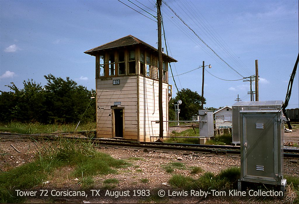
which was authorized for operation on November 21, 1907. Tower 72 was a 2-story manned tower
in the southwest quadrant of the diamond with a mechanical
interlocking plant that supported 23 functions. The files of DeGolyer Library show
that this interlocker was not static over the years, and indeed, there is
photographic proof of a substantial change to the design of Tower 72.
Modifications to the tower were initiated in letters to RCT dated April 14,
1932, September 30, 1940, September 30, 1952, and April 21, 1954, but the nature
and extent of these modifications remains to be determined. Tower 72 was
active for many years, but was retired and razed, reportedly in 1984. Farther north, the
T&BV crossing of the H&TC was grade separated. Oddly, although it was the T&BV's
task to cross the existing H&TC, they did so by going
under the H&TC's bridge over Post Oak Creek (and presumably it's always
been that way.)
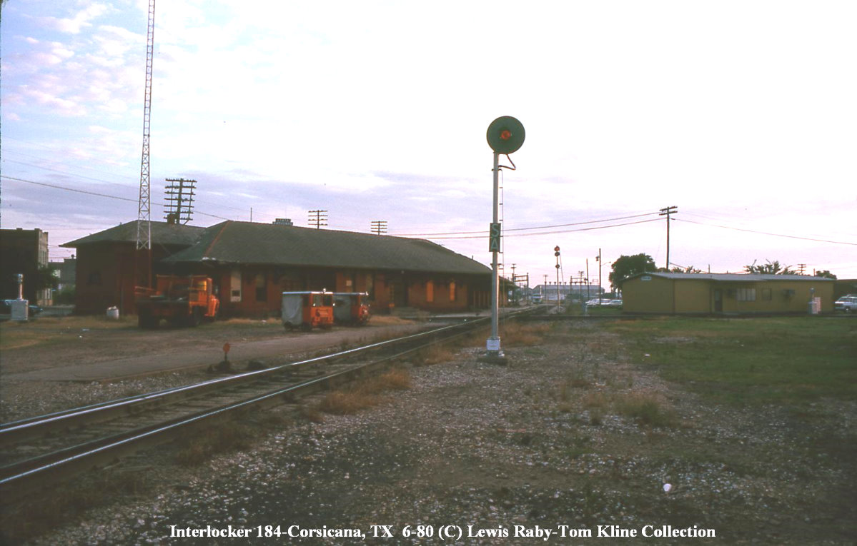
The H&TC/Cotton Belt crossing 1,500 ft. west of Tower 72
was not originally interlocked. By law, all trains were required to stop, but
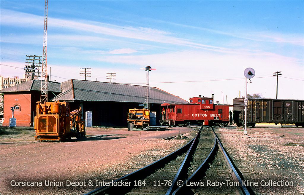
this was not a significant issue because the Union Passenger Depot was located
on the northwest corner of the crossing. All trains on the Cotton Belt and H&TC
would stop anyway, or else be traveling slow enough that a full stop was not a
significant time impact. In the 1930s, railroads began submitting interlocking
plans to RCT to cover their own crossings which had been exempt from RCT
approval until that policy began to change in the late 1920s. The Cotton Belt
had come under SP's control in 1932, and the H&TC had been merged into SP's
operating railroad for Texas, the Texas & New Orleans (T&NO) Railroad, since
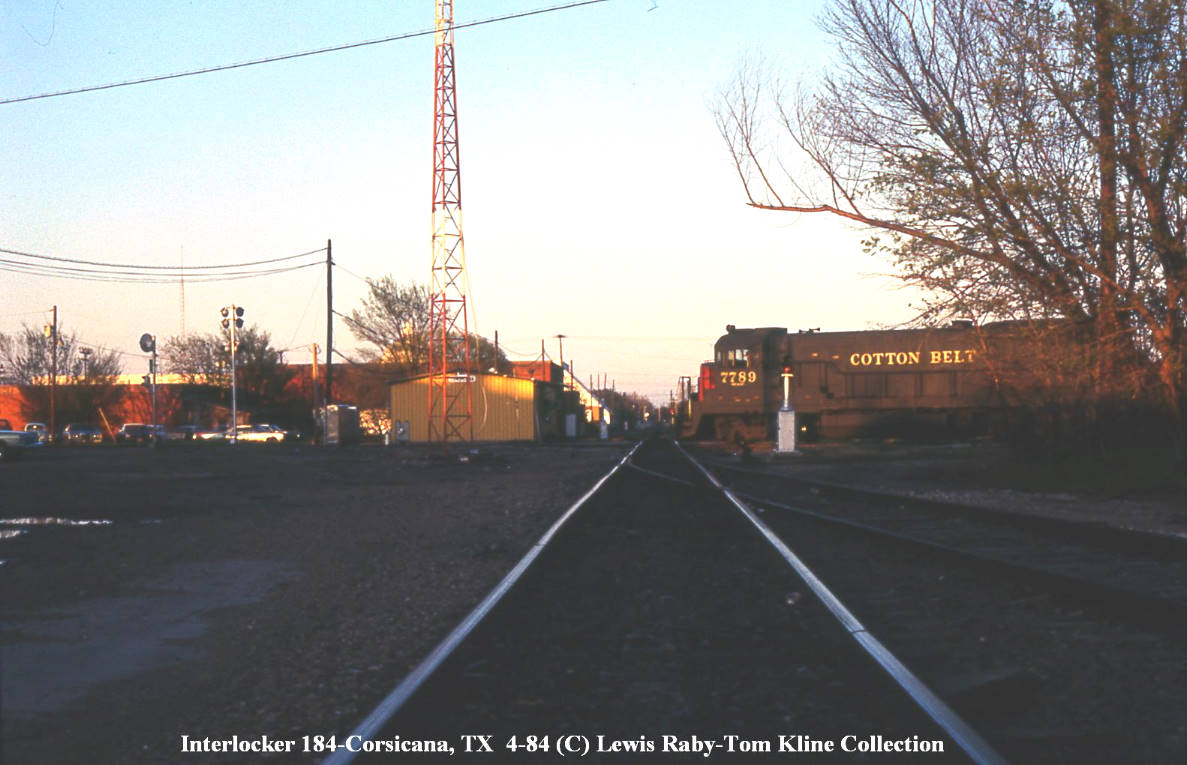
1927. An interlocker was installed for the Cotton Belt/T&NO crossing, and on
December 21, 1937, interim authority to begin operating the newly designated
Tower 184 was granted with the interlocking controls located in the Union Depot. On February 19, 1945, T&NO requested "permission to install an additional
color light dwarf signal" for this interlocker, but otherwise, this interlocker
appears to have had few changes over the years. The crossing at Tower 184 was
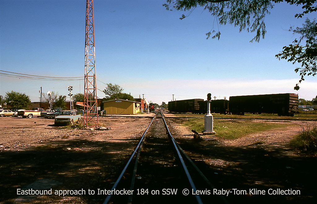
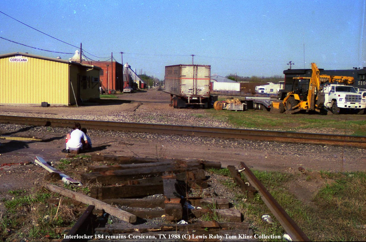
retired in 1988 when the Cotton Belt line west of the junction was abandoned.
Now, the former Cotton Belt line curves to the south and joins the main line
heading toward Hearne, both owned and operated by Union Pacific (UP).

Above Left: Looking north
past Tower 72 along the ex-T&BV main line through
Corsicana, the Cotton Belt
crossing is just past the tower. On the left in the distance is the turret of
T&BV depot, still utilized by
the BNSF Railroad. (photo courtesy of Gary Morris)
Above Right: a close-up of the tower and its order hoop. (photo courtesy of Gary
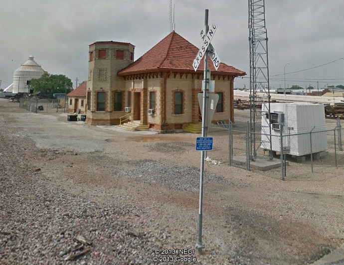
Morris) Below Left: A May,
2013 Google Street View looks north toward the site of where Tower 72 once
stood. Compare this view with the photo above.
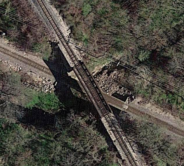
Below Right: This Google Earth satellite view shows the
ex-T&BV tracks crossing under the ex-H&TC tracks north of town. Either the T&BV
always went under an existing H&TC bridge, or this grade-separated crossing was
restructured, then or perhaps later.

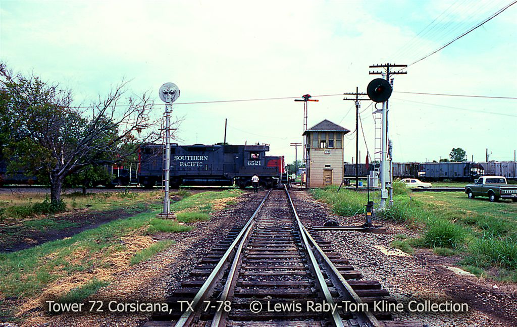
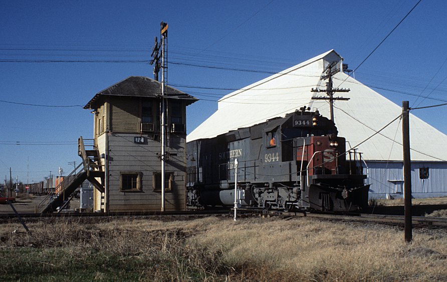
Below: John Carr took
this photo on December 15, 1977 and describes it as "...Extra 9344 East (the
Merchandise - train symbol LAEST) has set out the cars for Dallas, made its air
test, and is now crossing the B-RI mainline..." (used with permission)

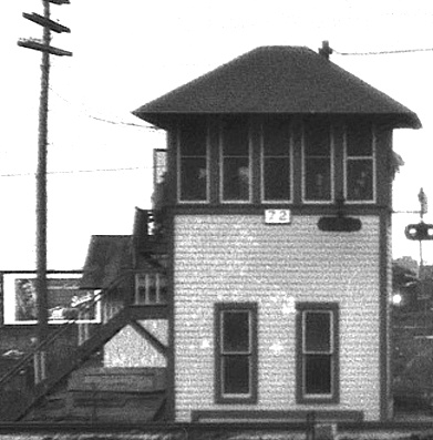
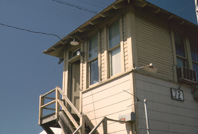
Above left: When a young Myron Malone (Webmaster Emeritus of this website)
was photographed at Tower 72, he was looking south
down the B-RI while standing on the Cotton
Belt tracks. The side of the tower ahead and to the right of Myron showing two
windows on the bottom floor is the tower's east face. (Robert W. Courtney photo)
Above Right: Compare
Barriger's east face view with that of the east face in the photo above left to
see the substantial difference in the tower design. It certainly looks like a
completely new tower, but details are lacking.
Above: Everett DeGolyer, Jr.
took this photo of Tower 184 in September, 1960. Note the '184' tower indicator hanging below
the 'Corsicana' sign on the side of the Union Depot. (photo courtesy of DeGolyer Library, Southern Methodist University)
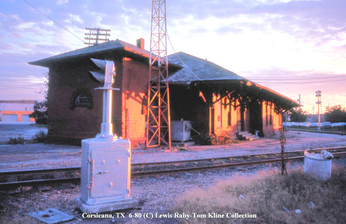
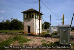
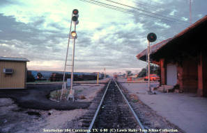
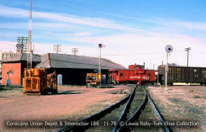
Photos of Corsicana rail activities from the Tom Kline collection (click to enlarge)


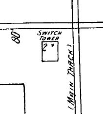
Above:
The 1910 Sanborn Fire Insurance Co. map of Corsicana shows the location of Tower
72 in the southwest quadrant of the crossing. Under magnification (right), the map reveals a two-story "Switch
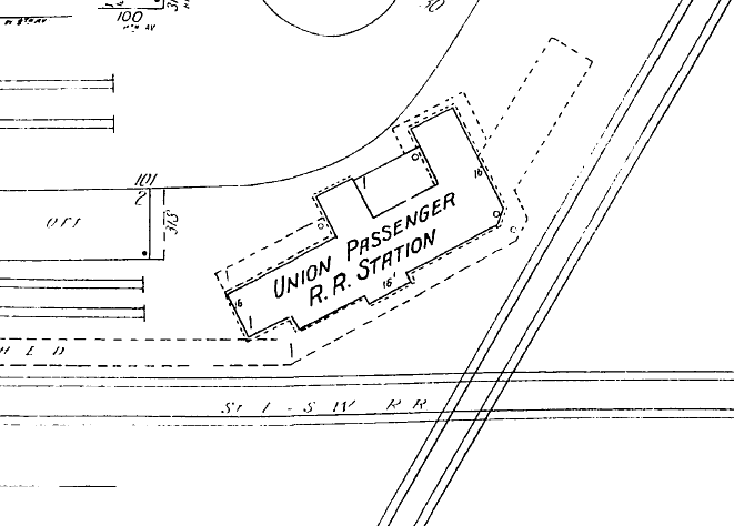
Tower". Below: The
Sanborn map shows the location of the Union Passenger Station in the northwest
quadrant of the Tower 184 crossing.
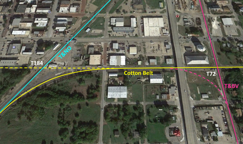
Above: This Google Earth view of Corsicana
shows the ex-T&NO line (left) and ex-T&BV line (right) running north, angling together
toward an eventual grade-separated crossing on the north side of town. The former Cotton Belt line
crosses east-to-west (right-to-left) in the center, but it no longer continues west
of
the T&NO line since the segment to Waco was abandoned in 1988. Instead, it
curves to join what is now the Union Pacific main line to the south toward
Hearne. The depot and tower structures are long gone, although the T&BV depot
survives (see Google Street View below), barely visible at the top edge
of the above image along the T&BV line.