Texas Railroad History - Tower 174 - Italy
A Crossing of the Missouri-Kansas-Texas Railroad and
the Texas Electric Railway
The town of Italy, supposedly named for its Mediterranean climate,
was incorporated in 1891, shortly after the Missouri-Kansas-Texas (MKT)
Railroad ("the Katy") arrived as it built from
Waxahachie to
Hillsboro. Ten years later, Italy received its second railroad, the
International and Great Northern (I-GN), which was completing a major line from
Spring, near Houston, to Ft. Worth via Waco. The I-GN crossed the Katy north of
town, but the crossing was not at grade; the I-GN passed over the Katy on
a bridge. The two railroad stations were approximately a quarter mile apart,
with the I-GN depot near what has since become "downtown" Italy.
Some impetus for the growth of downtown
Italy may be traced to the arrival of
the Southern Traction Company's electric interurban rail line from Dallas to
Waco in 1913. The name became Texas Electric (TE) when the Southern Traction Co.
merged with the Texas Traction Co. in 1917. Much of the TE's route south from
Waxahachie paralleled the Katy, but the TE turned east just before reaching Italy and
then curved back to enter town on a southwest
heading. The tracks ran down Main St., crossing the I-GN at grade at Ridge St.
where the TE's passenger station was located. As far as is known, this grade
crossing was uncontrolled since it does not appear in the Railroad Commission of
Texas (RCT) list of numbered interlockers. As an uncontrolled crossing, all
trains were required to stop, but this had little effect on the TE; all interurban trains
would be stopping for passengers anyway. The crossing was a block north of the
I-GN passenger station located at the intersection of Ridge and Poplar streets, so
assuming that many (or perhaps most) I-GN
trains stopped at the station, the delay at the uncontrolled crossing was
potentially negligible. An I-GN timetable from 1932 states that 6 mph was the
maximum permissible speed over the TE crossing in Italy (but the crossing and
its new interlocker were otherwise
unreferenced.) Also, I-GN's posted yard limits in 1932 extended for 3 miles through
Italy, so other special rules may have applied.

Above Left: This index map of the 1921 Sanborn Fire Insurance map of Italy
has been annotated
to highlight rail lines and stations. Note the proximity of the I-GN/TE grade
crossing to TE's station downtown. Above
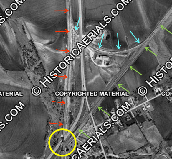
Right: North of the I-GN bridges over the Katy and US 77 (yellow
circle), there was a connecting track (blue arrows) between the I-GN (red
arrows) and the Katy (green arrows). The operational purpose has not been
determined. ((c)historicaerials.com, 1964)
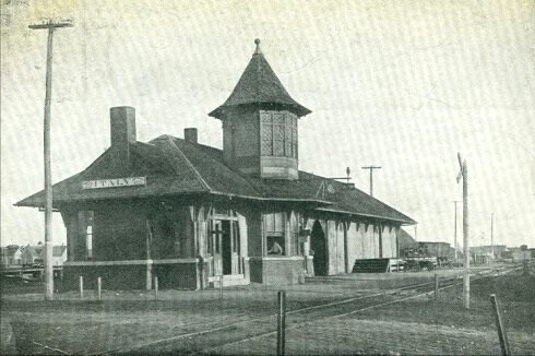
Above: Katy depot,
Italy, date unknown (Richard Makse collection) |
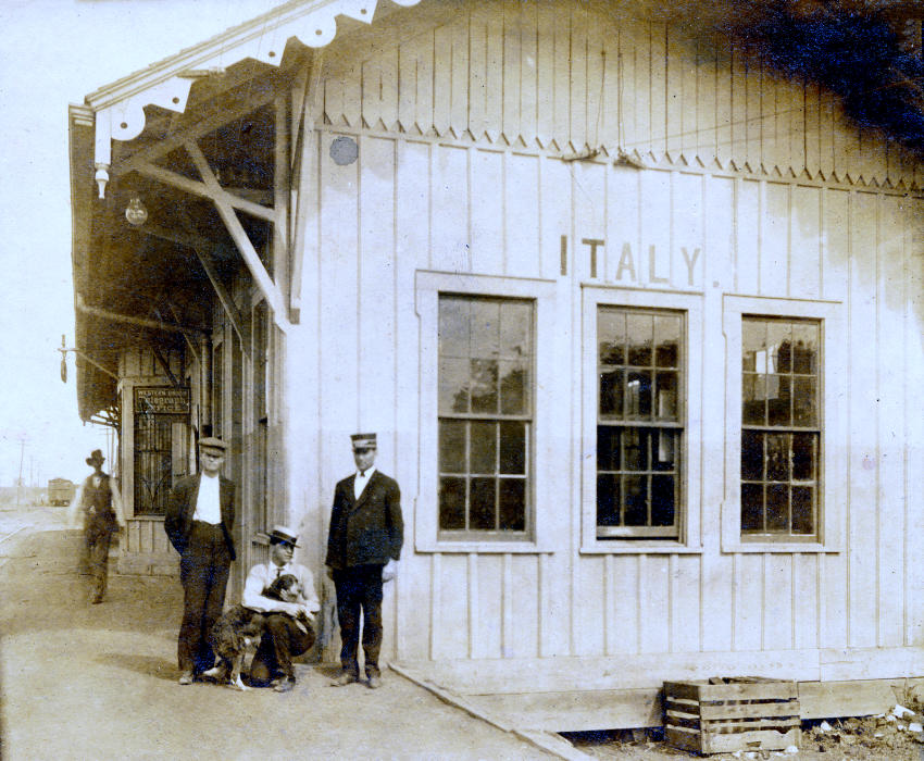
Above: I-GN depot,
Italy, 1910 (Dennis Hogan collection)
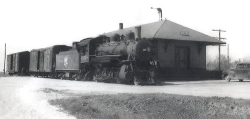
Above: Katy depot,
Italy, 1946 |
Heading southwest, the interurban tracks continued past
the station and immediately routed onto Clark St., angling toward the Katy
tracks on the southwest side of Italy. Where Clark St. ended, the tracks
continued, crossing the Katy at grade and then paralleling it much of the way to
Hillsboro. In 1931, an interlocker was approved for this crossing, designated
Tower 174. Since this crossing existed in 1913, it presumably was uncontrolled
until the interlocker was established. While the specific impetus for installing
the interlocker is unknown, it is notable that that around 1931, four
interlockers involving the TE were established, of which Tower 174 was the last.
The others were at Plano (Tower 166), Corsicana (Tower
165) and Hillsboro (Tower 167). This suggests
that there was some mandate to upgrade controls for TE's crossings of Class 1 railroads.
The interurban tracks through Italy were abandoned in the 1940s. The I-GN
line was abandoned by successor Missouri Pacific in 1967; the Katy line through
Italy was abandoned in the 1980s.

Above Left: The Tower 174 interlocker electronics cabin
is shown in this photo from the collection of Dr. George Winn. The Katy rails
aren't visible but the Katy right-of-way parallels the line of utility poles
extending into the distance. The Texas Electric car appears to have just
crossed the diamond. (hat tip, Jimmy Barlow)
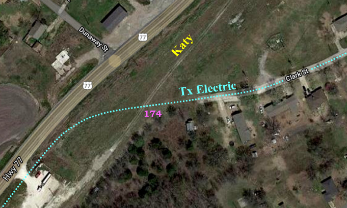
Above Right: The crossing at Tower 174 is easy to visualize with this
annotated satellite image
of the southwest side of Italy.
The Texas Electric remained between US77 and the Katy for the trip south to
Hillsboro.
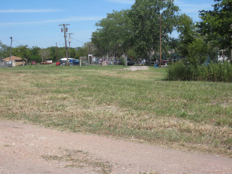
Above Left: Facing
northeast, the camera is on the Katy right-of-way (ROW) which is being used as a gravel road
for a nearby construction
site. In the distance, where Clark St. ends, the Texas Electric tracks would have
departed Clark St.
and continued straight toward the camera, crossing the Katy
at Tower 174 about where the camera is located. The abandoned rails remained visible in
Clark St. until
they were removed (or perhaps
covered) by a repaving project c.2000. (Jim King photo, 2008)
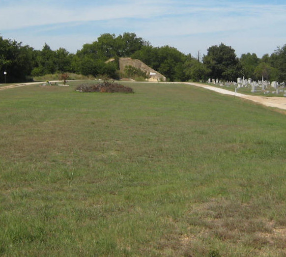
Above Right: Facing north along the I-GN ROW,
the concrete abutments visible in the distance mark the location of I-GN's
bridge over the Katy. The I-GN ROW traversed this low area using a fill to rise
high enough to reach the top of the abutment. Eventually, the fill was removed
to provide expansion room for Italy's cemetery (Jim King photo, 2008)
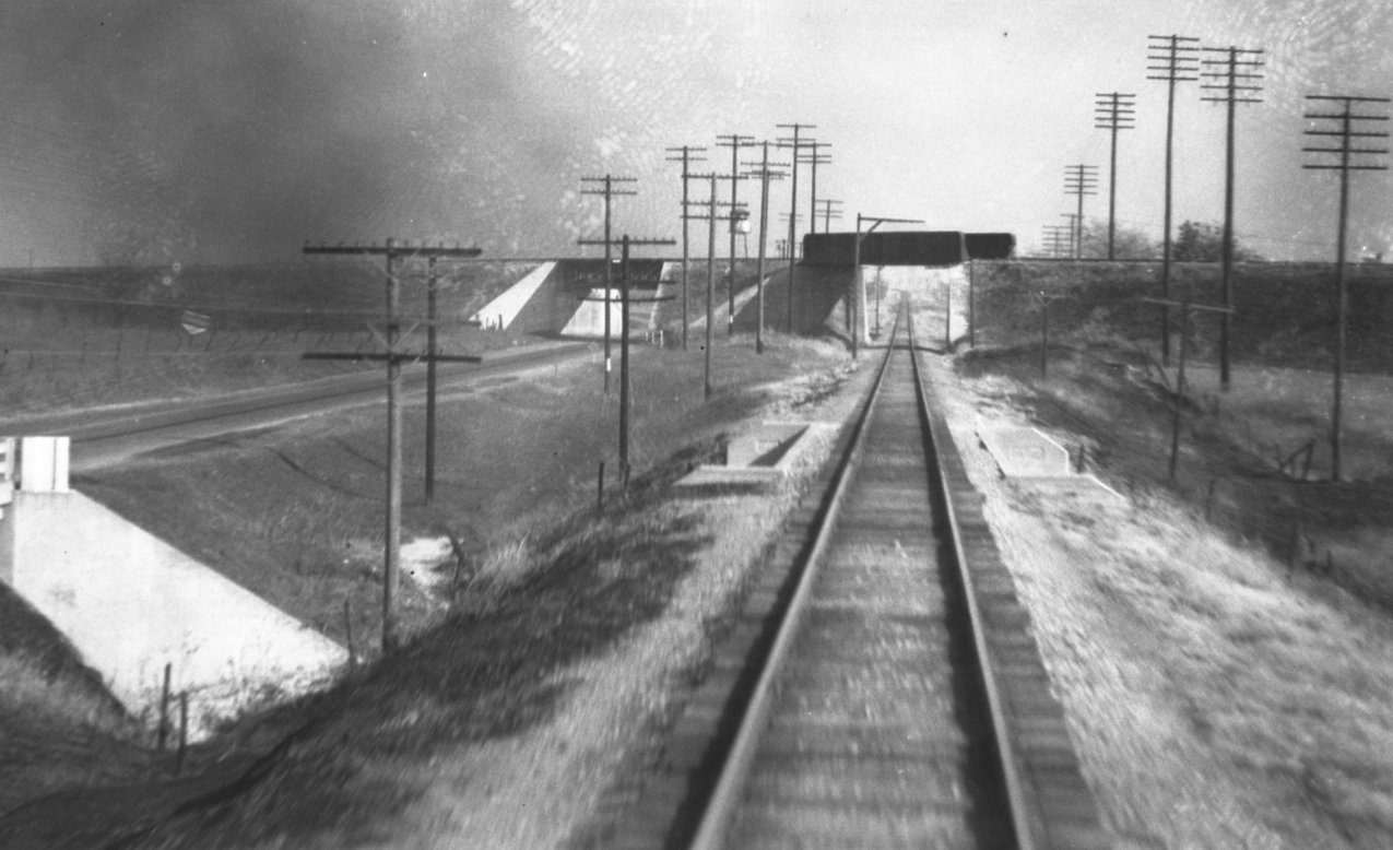
Below: John W Barriger III
took this photo facing north out the rear of his business car as his train proceeded south on
the Katy tracks through Italy c.1940. As it was his habit to photograph railroad
infrastructure, Barriger had just spotted the I-GN bridge
over the Katy tracks and the adjacent bridge over US 77 to the left. Note
the large fill extending to the right, the one removed to expand Italy's cemetery. (John
W Barriger III National Railroad Library)
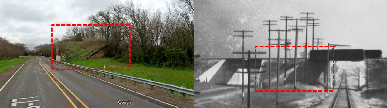
Below: Although the
perspectives are slightly different -- one is from the highway and the other is from the
tracks -- the I-GN bridge abutment that is visible today from US 77 (2020 Google
Street View, below left) is clearly the same one that Barriger saw 80+ years ago
(below right).
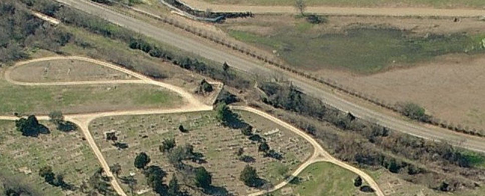
Aerial Imagery, Italy (Microsoft Virtual Earth)
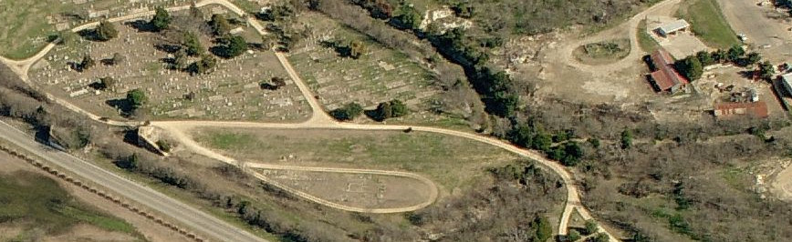
Above: Facing east, the I-GN bridge abutments are visible adjacent to US77,
with the abandoned Katy ROW passing between them,
paralleling the highway. From the south (right) abutment, the I-GN ROW can be
followed horizontally across the cemetery and through a wooded area, entering
downtown at far right. Below:
Facing west, the abandoned Katy ROW is easily seen paralleling the highway and
passing between the I-GN bridge abutments. The Katy bridge over Houston Creek
appears to remain in
place at upper left in the image.