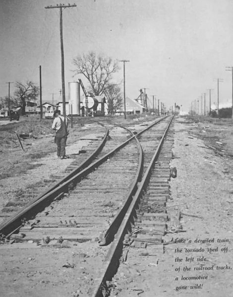
Above: Cody Newman supplies this image from the publication The Central Texas Tornados, Burnet..Hubbard. The view appears to show Tower 46 in the distance, but the date, the direction of the photo and the location have not been determined.
A Crossing of the Trinity & Brazos Valley Railroad and the St. Louis Southwestern Railroad
Above: Cody Newman supplies this image from the
publication The Central Texas Tornados,
Burnet..Hubbard. The view appears to show Tower 46 in the distance, but
the date, the direction of the photo and the location have not been determined.
By 1881, the Texas & St. Louis Railway had built from Texarkana southwest
through Tyler to Corsicana. Construction continued west that year toward Waco,
passing through Hubbard, a
small, unincorporated farming community that became incorporated due to the
railroad's arrival. In 1902, the
newly chartered Trinity & Brazos Valley (T&BV) Railroad established corporate
offices in Hillsboro and began construction there, building southeast to Mexia
in 1903 and northwest to Cleburne in 1904. The line to Mexia passed through
Hubbard where it crossed the former Texas & St. Louis line which had been
acquired in 1891 by the St. Louis Southwestern (SSW, "Cotton Belt") Railway. Shortly thereafter, a manual interlocker,
Tower 46, was authorized for operation in Hubbard on July 7, 1904. That date
appears to have been chosen so that all of the T&BV interlockers on this line (Tower
45 at Malone, Tower 44 at Hillsboro and
Tower 43 south of Cleburne) would begin service on
the same day.
While the T&BV had an interesting place in Texas
railroad history, this part of its
route system saw limited traffic, and the line from Hillsboro to Hubbard was
abandoned in 1935. Tower 46 was decommissioned in 1940, and in 1942, the T&BV
line from Hubbard to Mexia was abandoned. Much of the former T&BV right-of-way is now
occupied by Texas Highway 171 between Hillsboro and Mexia. The Cotton Belt was
absorbed into the Southern Pacific system and the line to Waco was abandoned in
the 1980s.

Above Left: This 1909 Sanborn Fire Insurance Map of Hubbard shows the crossing of the
two railroads at the top center of the image at what is actually the northeastern edge of town. The T&BV line
from
Hillsboro to Mexia crosses left-to-right at an angle, with a spur extending
vertically
down to the center of town. The Cotton Belt line rises vertically from the
bottom of
the image (southwest) to the northeast with a slight easterly curve before it
crosses the T&BV
crossing at Tower 46. Above Right:
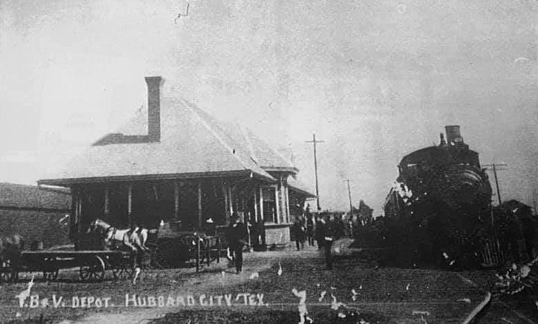
A passenger train has stopped at the T&BV depot. (Cody Newman collection)
Below: the Cotton Belt depot in Hubbard, date unknown (Chino Chapa
collection)
Tower 46 Location

Tower 46 Location, Google Street View

Above: Tower 46 would
likely have been visible in this view looking approximately north from SE 2nd
St. The Cotton Belt grade is visible as a low hump in front of the tree line.
The T&BV crossed at nearly a right angle, and it is possible that the gravel in
the foreground is a distant remnant of the T&BV grade. Neither the nature of the
tower structure nor its location relative to the diamond has been determined.
Below: The
T&BV grade is visible looking north from its crossing of Farm Road 3325.
